
Key Points – Wednesday, February, 1, 2017 – next week
Synopsis: Good morning and thanks for checking out the latest update! Radar indicating a little drizzle, sprinkles and snow flurries across the central Midwest locations this morning…overall this has more bark than bite as surface temps are well above freezing. The next piece of energy that sparks some interest is Thursday night into Friday morning…it is a very disorganized piece of energy, perhaps we are looking at some fluffy snow showers with temps in the low to mid 20s…we have to consider this for a few slick surfaces on the commute Friday morning. Going into the weekend, we have a system moving in Saturday night into Sunday offering up some type of wintry precipitation across the Midwest…temps warm very quickly on the day on Sunday, so any snow or wintry precipitation that comes down or accumulates will have a hard time sticking around. Additionally, we have another system moving in Tuesday into Wednesday…strong or gusty storms possible with a big warm up. (50s/60s?) and big cool down which is common with a strong system this time of year. In terms of the long-range forecast, the models are trying to forecast a split in the polar vortex…if this happens, the coldest air on the Planet could filter into the Ohio Valley end of February into March. WITH THAT BEING SAID, this is a HUGE wildcard, it could definitely change our tune on the remainder of the winter or it could completely fall apart.
Latest radar update this morning…most of this not reaching the ground due to Virga (dry air causing precipitation not to hit the ground) working in…however, some spots of drizzle, sprinkles or wet snowflakes are possible.
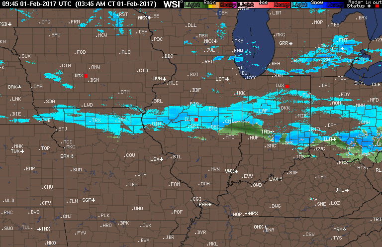
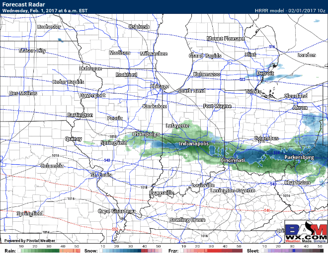
This morning’s HRRR simulated radar shows the precipitation moving off to the east throughout the day…with that being said, we believe most of this will continue to be Virga, meaning not likely much of it will reach the ground. A few snow showers possible across northern IN, southern MI and NW OH throughout the afternoon into the evening as well (little to no accumulation expected).
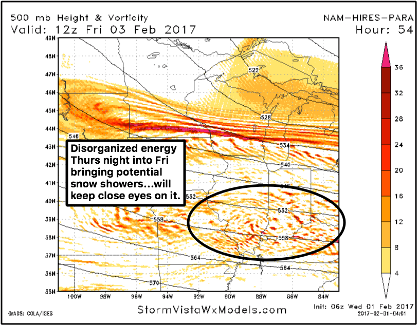
The next piece of energy that sparks some interest is Thursday night into Friday morning…it is very disorganized piece of energy, perhaps we are looking at some fluffy snow showers with temps in the low to mid 20s…we have to consider this for a few slick surfaces on the commute Friday morning.
Going into the weekend, we have a system moving in Saturday night into Sunday offering up some type of wintry precipitation across the Midwest. Once again, it’s a sprawled out, disorganized piece of energy, initially snow accumulations of 1-2″ are possible Sunday morning, but given how quickly temps respond into the 40s on Sunday, it will be difficult for any of accumulations that may fall to hang around.
European showing some snow still possible Saturday night into Sunday.

European solution on snowfall accumulations…1″ maybe 2″ localized possible based on latest data.

Monitoring another strong system Tuesday into Wednesday next week…strong or gusty storms with some heavy rains possible? Video has details but it’s something we can’t ignore right now. Temperatures behind this system will return back to a “winter” feel.
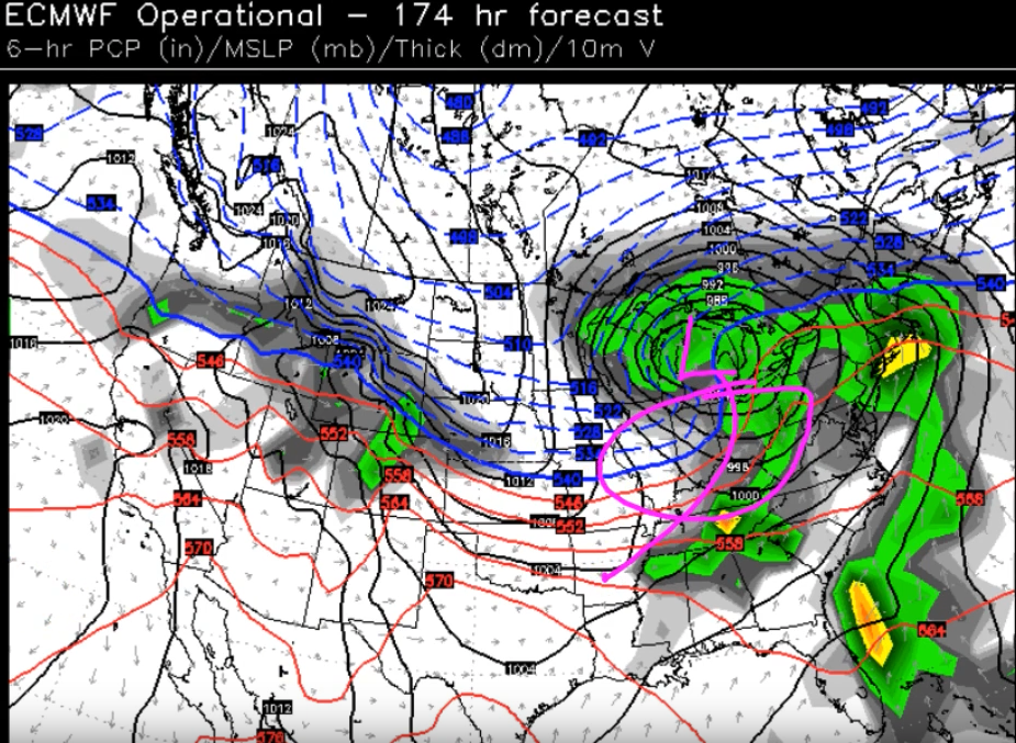
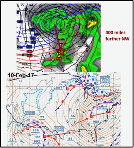
Using our organic forecasting techniques, it nailed the low pressure location moving up into Michigan (based on our experience, these pressure systems tend to trek ~400 miles to the northwest), simply meaning snow for the most part likely staying out of the Ohio Valley, but a strong storm scenario not off the table.
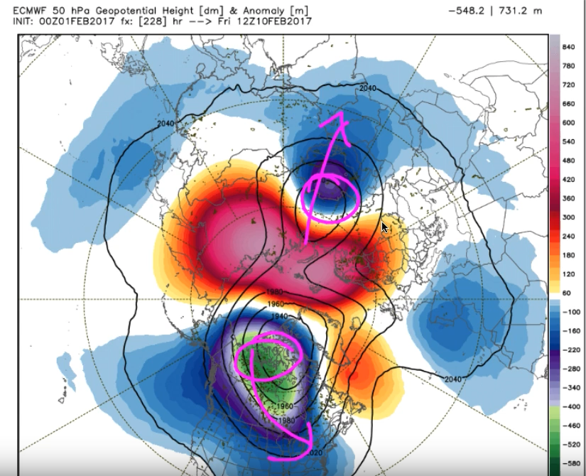
We also mention in the video the HUGE wild card in a polar vortex (15-20 day lag time taking it into late Feb/early March)…if this splits it would drastically change the way the winter would unfold. Remember, this is a MAJOR IF, confidence is very low on this scenario at this time.
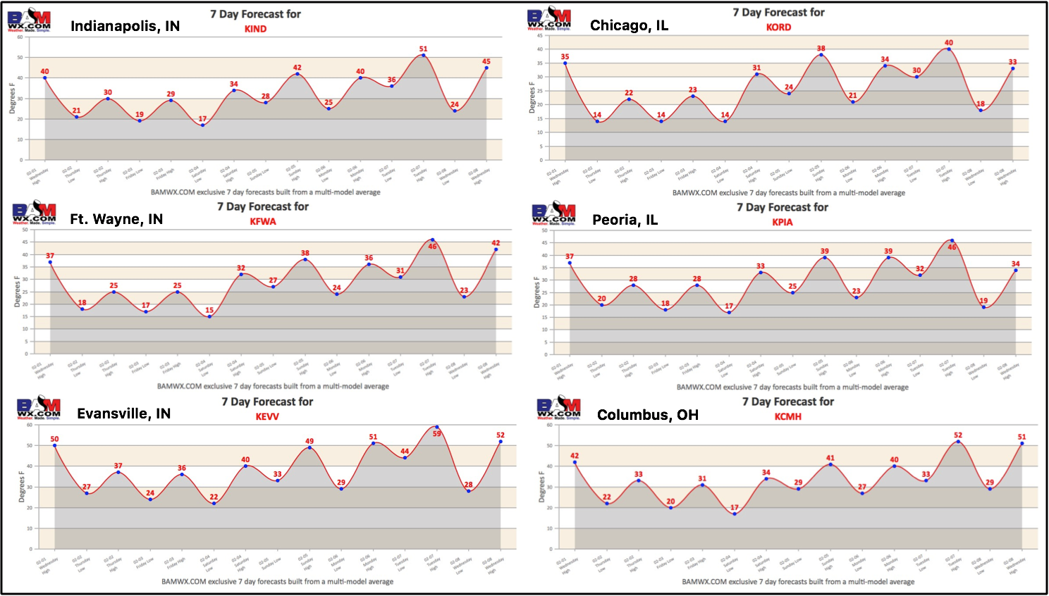
Below is the latest 7-day forecasts across the Midwest
Confidence and Risk:
- Average confidence a few sprinkles to snow flurries continue across the central Midwest this morning before pushing east…dealing with a lot of dry air so a lot of this not hitting the ground.
- Increasing confidence of a few snow showers possible Thursday night into Friday morning with disorganized energy present.
- Average confidence in terms of the details on the system Saturday night into Sunday brining accumulating snow…temps warm near the 40s during the day, will be hard for this to stick around.
- Increasing confidence of gusty to strong storms Tuesday into Wednesday next week as a powerful low pressure system moves into the Midwest.
Today’s Video (7 min):