
#ILwx #INwx #OHwx Tue PM Short-term:
Synopsis: Good Tuesday afternoon and thanks for checking out the latest short-term post regarding the timing of rain to snow Wednesday across the Midwest. This is not a major event by any means, but there are some concerns in regards to the impacts. The cloud cover today, as we mentioned this morning, was going to be a major factor whether we were going to see storms intensify or die eye…and it panned out where things remained cloudy and we didn’t see much of anything in the way of stronger storms. We have a slight concern for a little refreeze on surfaces across NW portions of the Zones tomorrow morning where temps fall below 30ºF otherwise this shouldn’t be a big factor. In regards to the event on Wednesday, we do not recommend doing any kind of pretreating from basically from Davenport to Chicago south because this event will start out as mostly rain turning to snow as we progress throughout the day; north of Davenport to Chicago should stay all snow. In the video we discuss the battle of cold air throughout the morning into the afternoon with this wave moving through, initially it will be difficult for things to really “stick” because of a rain/snow mix for a lot of this. As temps fall throughout late afternoon to evening to below freezing is where things will gradually turn to all snow across the Zones. We will be battling with a more significant, widespread refreeze/black ice potential Thursday morning considering how quickly temps fall overnight…we recommend keeping close eyes on your lots especially ones that are no tolerance, and reaching out to us with your questions. Cloud cover on Thursday will likely start out largely mostly cloudy with clearing from west to east late morning into early afternoon.
Here’s the area we have a little concern for slippery surfaces Wednesday morning:

We time out the rain/snow mix to snow showers in the video in more detail, below is the simulated radar loop from the latest NAM-4km where we place more confidence with at this time.
Our thoughts remain consistent in terms of snowfall accumulation amounts of mainly 1-2″ with isolated higher amounts possible due to a strong upper-level jet moving through. With that being said, because temps will be flirting around freezing and mixing with rain initially at times, it’s a good bet to shave off around the first inch of this as things will likely melt quickly.

Black ice is a big concern Thursday morning as temperatures fall well below freezing across the entire Midwest and continue to fall on the day on Thursday. We recommend keeping close eyes on your lots and applying treatment as necessary, especially on lots that are no tolerance, and reaching out to us with your questions.
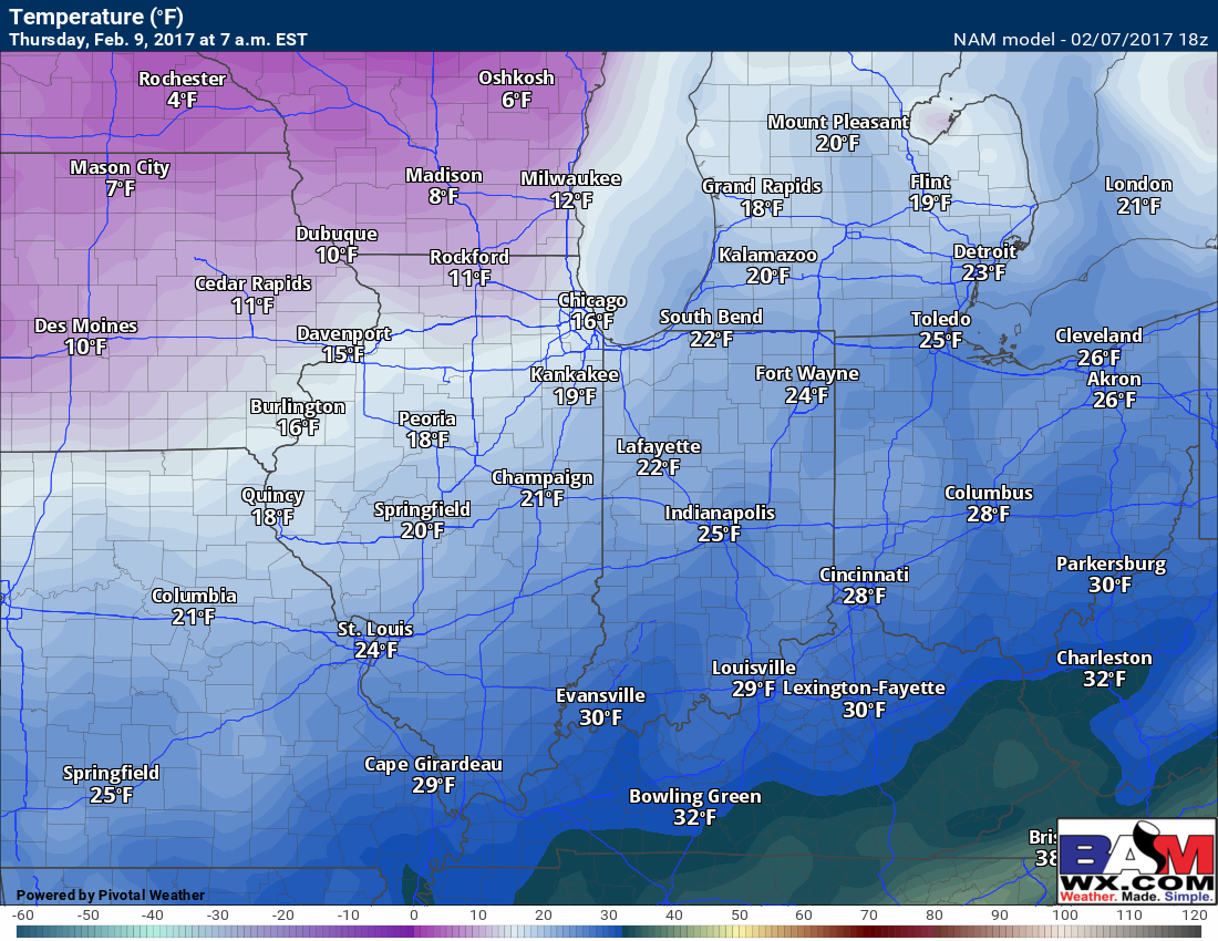
Cloud cover on Thursday will likely start out largely mostly cloudy with clearing from west to east late morning into early afternoon.
Confidence and Risk:
- Average confidence in a few slick spots tomorrow morning on untreated surfaces where temps fall below 30ºF.
- Above average confidence a rain/snow mix to snow event will move west to east across the Midwest tomorrow with potential of bringing 1-2″ (isolated higher amounts possible) of wintry accumulation.
- Increasing confidence of a more widespread black ice threat Thursday morning as temps fall fast overnight.
Today’s video (6 min):