
Key Points – Thursday, February 2, 2017 – next week
Synopsis: Good Thursday morning, thanks for checking out the latest forecast update! Today we focus on the latest data in terms of this weekend’s system moving through from west to east, as well as next week’s stormy and wintry weather potential. Partly to mostly sunny skies across the Midwest today, chilly with highs mainly in the 20s with winds out of the northwest 5-20 mph. The last 2-3 days we’ve been mentioning disorganized energy moving through Friday morning across the I-70 corridor from west to east that had the potential to bring some snow flurries to snow showers; we still have energy forecasted to move through, the issue becomes dry air working in, similar to the scenario we had yesterday morning. In terms of the system we’ve been forecasting to move through Saturday into Sunday, the energy is still very disorganized and scattered…and looking unimpressive at this point; in the video we mention snow showers possible as temperatures will be in the low to mid 30s with winds out of the south Saturday veering towards more west on Sunday 5-20mph. Temperatures return into the upper 30s to lower 40s quickly Sunday so nothing would stick around that would fall in terms of wintry precipitation. Return of storms and above normal warmth again early next week? Our latest data indicates Monday afternoon into Tuesday we will have energy or CAPE present as the low pressure moves into the Ohio Valley from southwest to northeast which indicates some thunderstorms will be possible. Our models also suggests we will have a fairly strong low-level jet lingering early next week as well, so we are keeping our eyes on the potential for heavier rains and gusty winds to work in as well. As the low pressure system departs, conditions will be windy and much cooler mid-next week. We touch briefly on the long-range as well, and the continued signs of February sustained warmth. Have a great day!
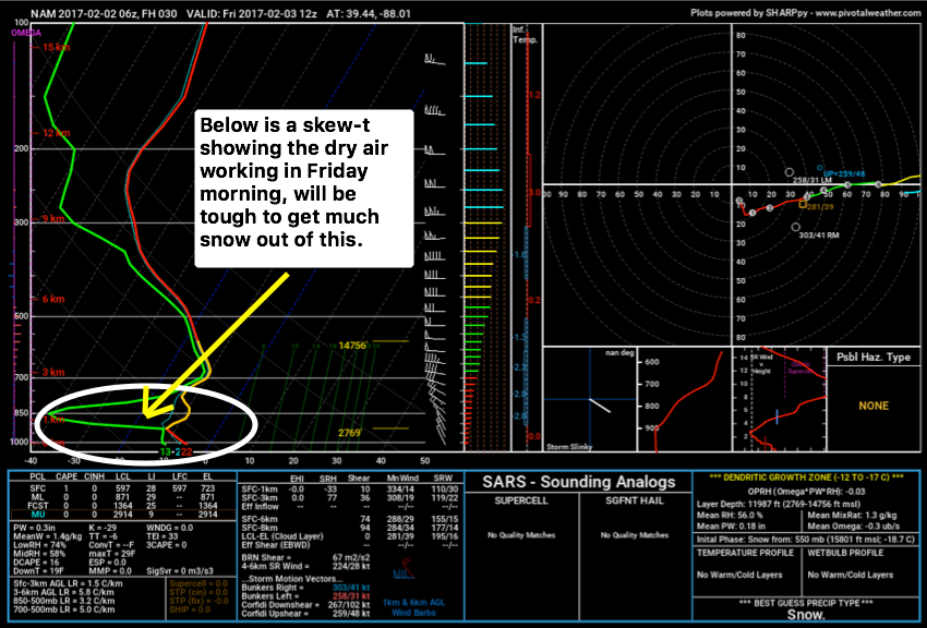
Still monitoring for the potential for a few snow flurries to showers moving west to east Friday morning, issue becomes dry air working in as seen below.
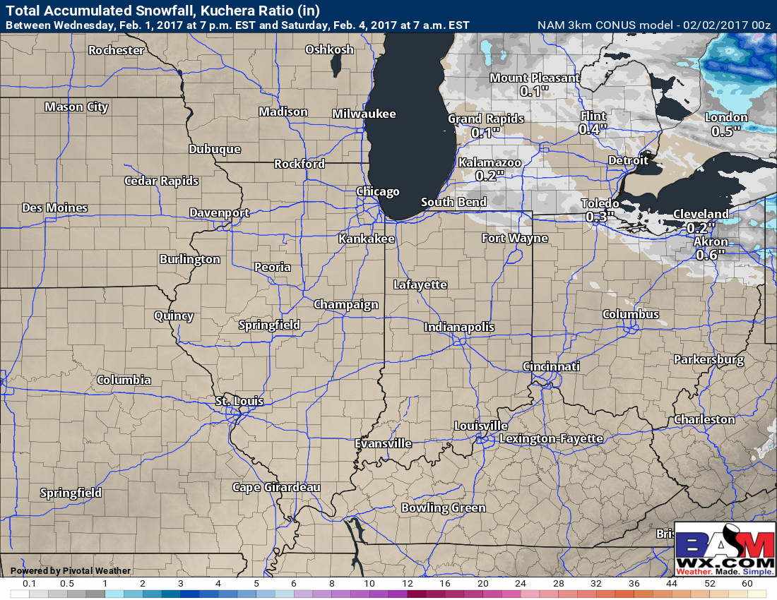
The 3km NAM shows the lack of accumulations well through Saturday morning.
Transitioning the forecast to this weekend, disorganized energy looks to push west to east (the yellows, oranges and reds below), but our latest data is unimpressed with widespread snow showers and unimpressed with snowfall accumulations as well because the jet streams just can’t seem to phase…it’s been the problem we’ve had all winter season.

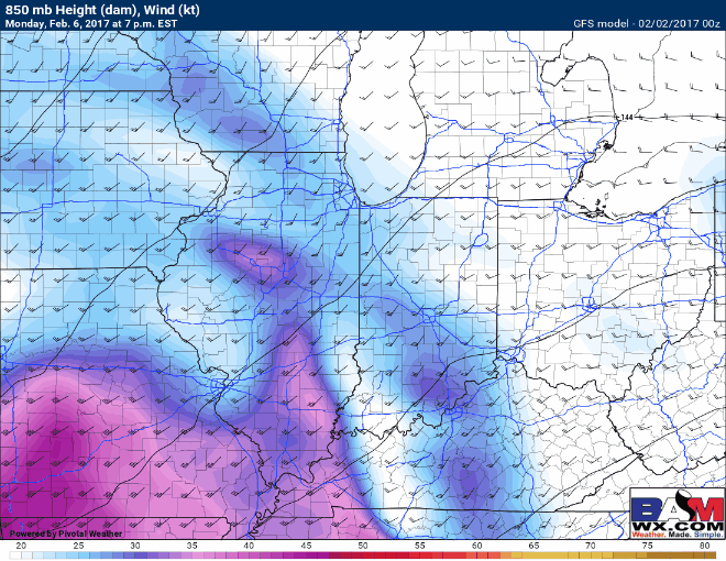
Showers and thunderstorms possible Monday night into Tuesday as we have some energy pumping into the Ohio Valley. Temperatures likely climbing into the 40s and even 50s at times as warm air pumps into the Midwest as well.

Low-level jet stream increases Monday night through Wednesday up to 55-60mph, which is why we need to watch for some heavier rains and gustier winds…wouldn’t count out a few strong storms as well we need to watch out for.
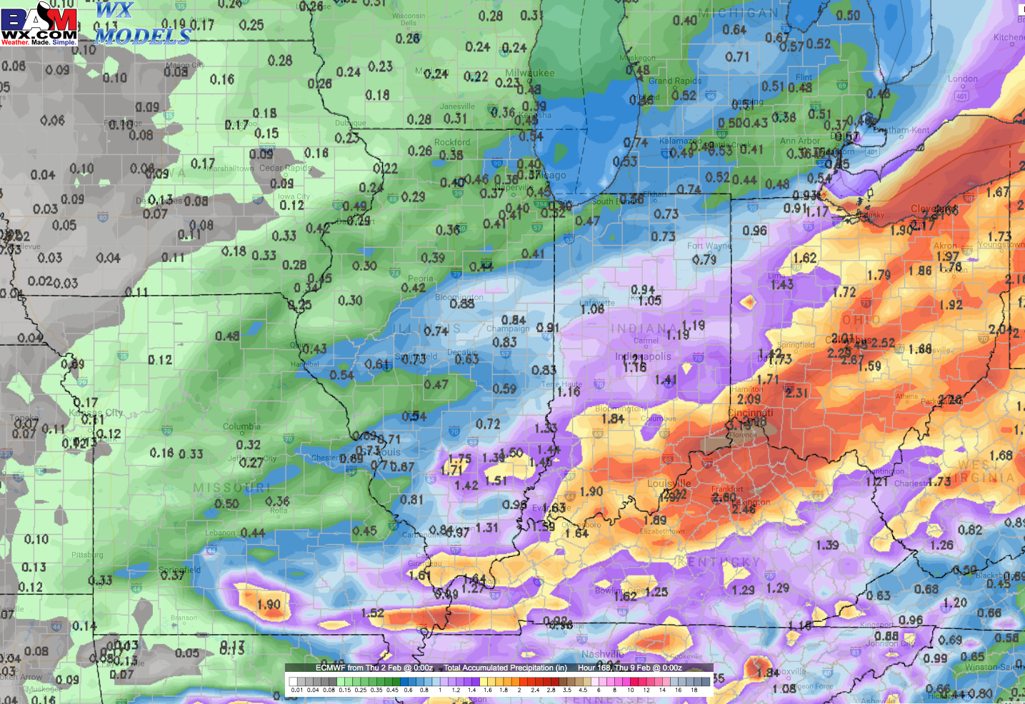
Total precipitation over the next week shows some heavy rains in the forecast, with the focus across southern Zones 3 and especially across Zones 1/2.
The signals for an overall warmer than normal February are getting very hard to deny at this point, below we see the CFSv2 forecast from mid-to-late month…we dig into the details in the video and will dive even deeper on our long-range update later this morning.

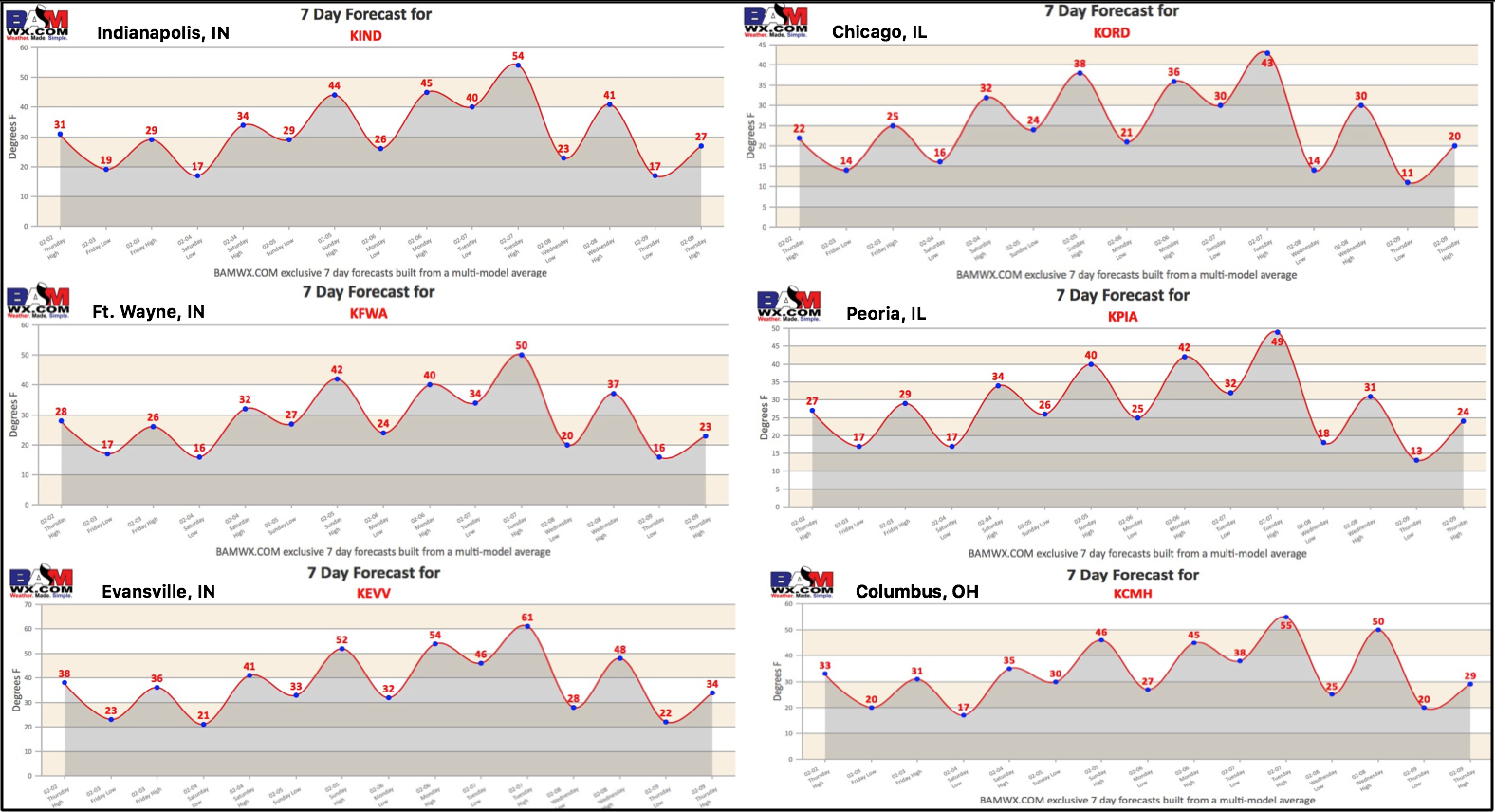
7-day forecasts around the Midwest through mid-next week…a roller coaster forecast for sure.
Confidence and Risk:
- Above average confidence today will be chillier with partly to mostly sunny skies across the Midwest.
- Average confidence in terms of snow flurries along the I-70 corridor Friday morning, issue with dry air working in.
- Increasing confidence of an unimpressive weekend weather event based on our jet streams not phasing, still watching for some snow shower potential.
- Increasing confidence of storms Monday night into Tuesday, some being heavy and gusty…need to watch for some strong storms.
- Increasing confidence of a warmer than normal month overall based on our latest data…signals are getting hard to ignore.
Today’s video (6 min):