
Key Points – Monday, February 6, 2017 – this week
Synopsis: Good Monday morning, we have a packed video today concerning a warm-up, severe weather and wintry weather this week so make sure to watch until the very end. Temperatures warm into the 40s and 50s today with some sunshine, as winds start veering out of the south then turning southwest tonight…gusting upwards to 30-40mph (higher gusts possible in stronger storms). Temperatures actually continue to warm over night with that strong southwest wind (warm-air advection) out ahead of this system. This is the timeframe where we have a continued growing concern for strong to severe storms into Tuesday…the first wave lifting off of the warm front into early tomorrow and the second moving east along a cold front tomorrow afternoon into the evening. On the backside of this powerful low pressure, temperatures drop off fairly fast…so a few slick spots where moisture freezes on contact are possible. Our attention then turns Wednesday night into Thursday for a little pulse of energy moving west to east bringing a potential 1-2″ and some slick spots…the NAM 3km is a little bit more aggressive with the snowfall totals so it’s a trend we definitely need to watch. ANOTHER system we need to watch is Saturday night into Sunday as we warm up…another rainmaker looms. Have a great week, we will have another short-term post out later today with updated details.
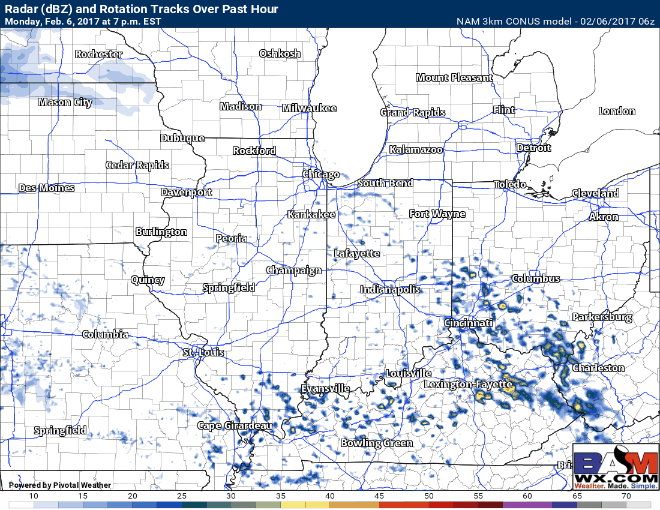
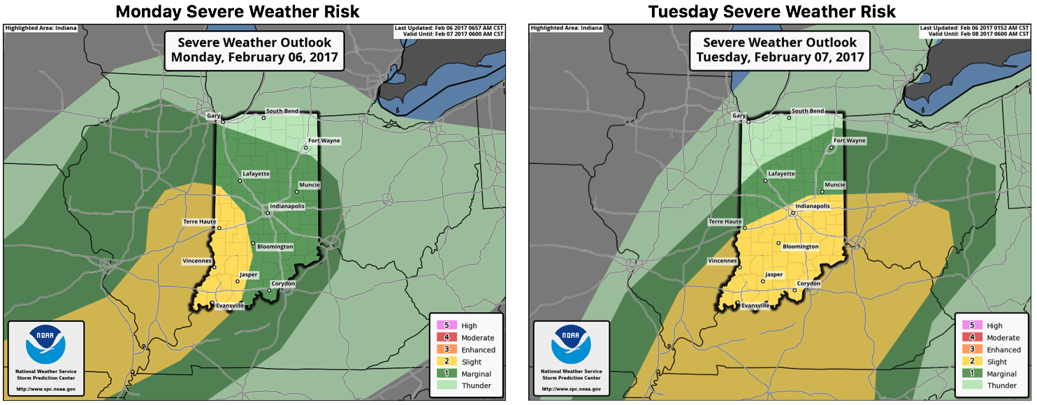
Watching our first wave of storms moving through tonight from the SW to NE off of a warm front…we have some serious concern for large hail especially across the southern half of Illinois and Indiana into the early Tuesday morning hours. If we receive additional sunshine today this could add more fuel to the fire tonight…something to definitely keep an eye on.
The second wave of storms moves east off of a cold front on the day Tuesday bringing similar risks to the table.
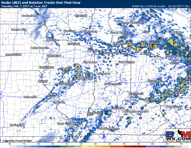
Latest Severe Weather risks tonight into Tuesday…we are watching for the potential for some severe hail tonight into early Tuesday, so we can’t urge you enough to make sure you have the ability to receive active severe weather warnings.
Temperatures on the backside of the departing low pressure system will be much colder…need to watch for a few slick spots where temperatures fall below freezing as shown below Wednesday morning.

Our focus then shifts to a little pulse of energy moving west to east across the Midwest Wednesday into Thursday that has potential to drop a little accumulating snow…our latest guidance suggests 1-2″ possible right now, with that being said the 3km NAM has been slightly more aggressive with snowfall totals so it’s a trend that needs watched closely.
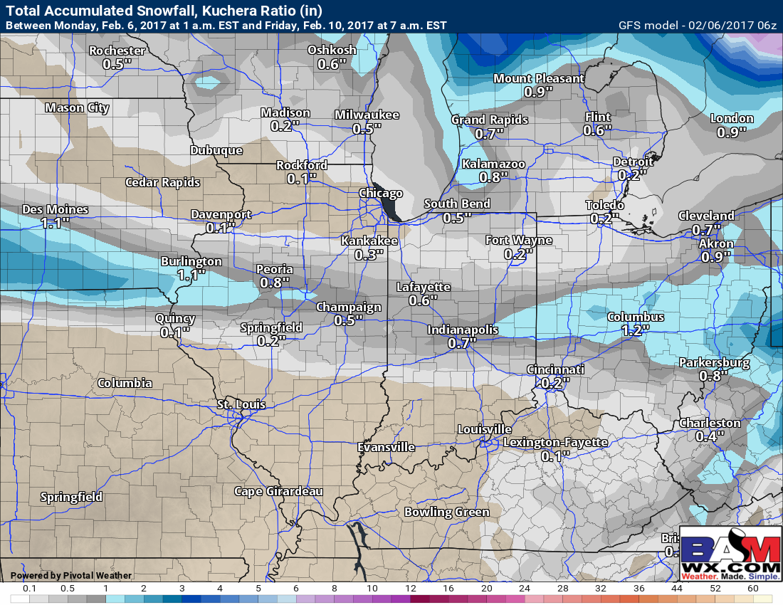
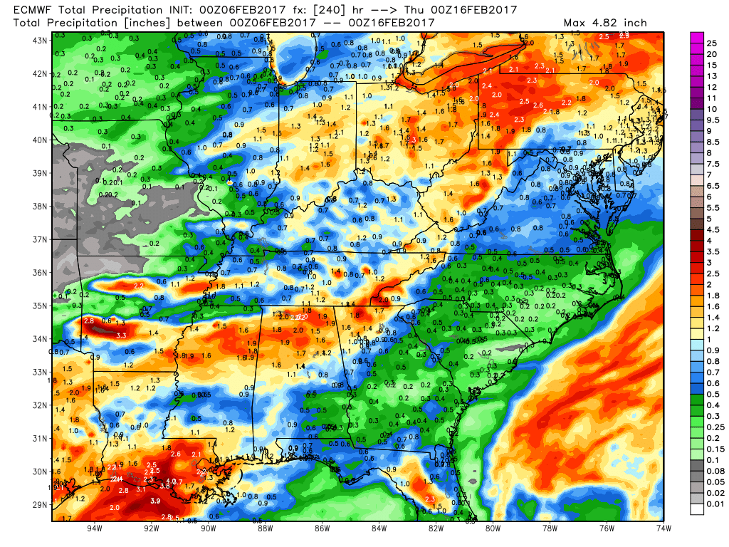
Rainfall totals over the next 10 days puts things into perspective in regards to how active it is…totals over and 1.0″ cover most of the Midwest.
A third system looks to move in across the Midwest Saturday into Sunday which we cover in the video. This is one of our most active weather weeks in long while, so make sure you are staying up to date with the latest details in regards to the forecast. Have a great week!
Confidence and Risk:
- High confidence temperatures are well above normal Monday into Tuesday.
- Increasing confidence of strong to severe storms across the southern half of the Midwest Monday night into Tuesday coming in 2 waves.
- Increasing confidence of a wave of energy moving west to east Wednesday into Thursday bringing the potential for accumulating snow.
- Increasing confidence of another rain maker this coming Saturday into Sunday.
Today’s video (7:30min):