
Key Points – Wednesday, February 8, 2017 – short term update
***THE EXACT PLACEMENT OF THE HEAVIEST SNOW IS STILL LARGELY UP FOR GRABS, STRONGLY ENCOURAGE YOU TO CHECK EACH AND EVERY UPDATE WE SEND OUT TODAY. LOOK FOR ANOTHER UPDATE BETWEEN 9-10AMest***
Synopsis: Good Wednesday morning! We wanted to get today’s update out to you as quickly as possible so you are covered with the latest details on timing of our snow accumulations today. Yesterday morning and throughout this week we have mentioned we were wary this may be an “over-performer” system given the impressive upper-level dynamics…latest hi-resolution models and radar data are beginning to confirm this. Currently, snow is moving east across Iowa and entering into western Illinois but initially we are running into some dry air. We have a concern that given the dynamics are slightly further south this morning, that the axis of heavier snows could move south as well. Skies will be mostly cloudy (a few peaks of sunshine looks to be possible as well) today and winds will be mainly out of the north from 5-10mph gusting up to 15-20mph this afternoon into this evening. In the video we also discuss a potentially tricky evening commute tonight and a continued threat for more of a widespread black ice/slick surfaces threat Thursday morning as temps drop down into the teens to even potentially in the single digits where a snowpack sets up; we definitely recommend monitoring your lots overnight for a refreeze of today’s precipitation. If you have any questions, please let us know and feel free to call at any time!
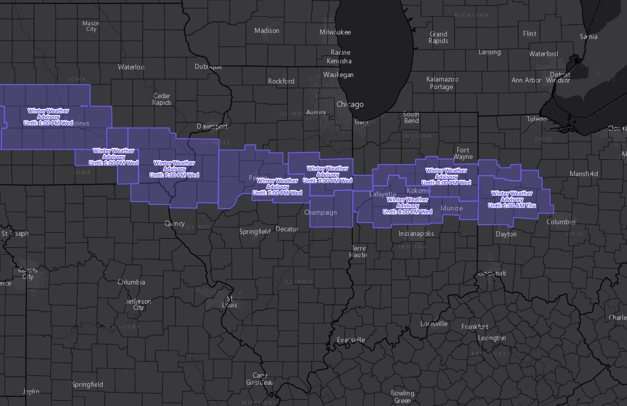
Latest Winter Weather Advisory Map…wouldn’t be shocked to see advisories expanded and/or upgraded to winter storm warnings as an over-performing snow event is possible.
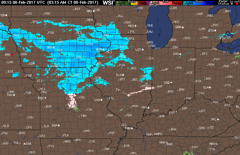
Latest radar across the Midwest this morning…some dry air eating causing things to initially not hit the surface.
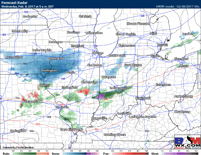
Hi-resolution simulated radar showing timing of precipitation today is below. All the details on timing are in the video. Growing concern for a tricky evening commute, monitoring for reduced visibilities from heavier snow bands and slippery roads.
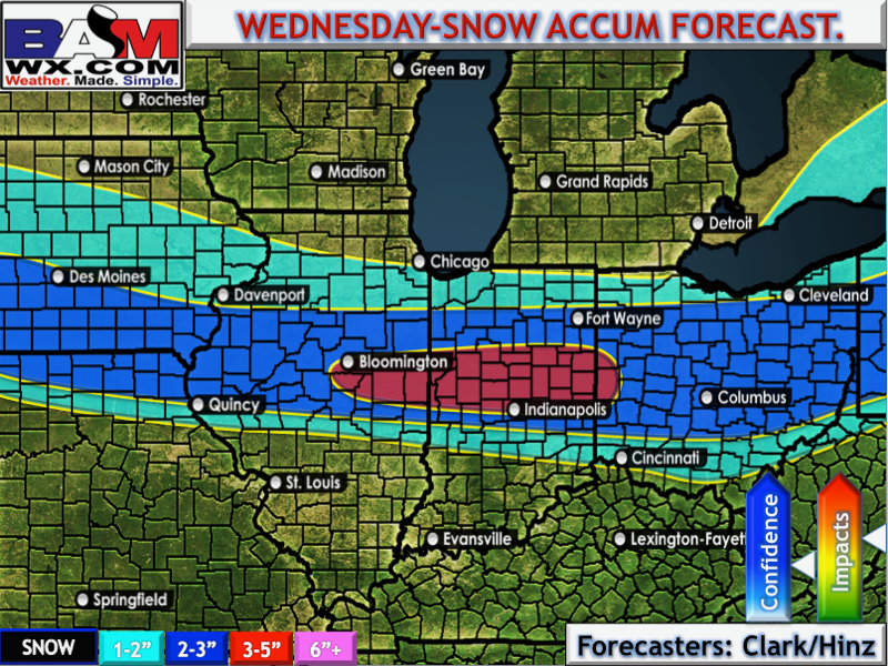
BAM updated accumulation map…we are monitoring for banding to form within this main wave, which is why we’ve outlined a small area with higher amounts forecasted. The dynamics suggest heavier snows could move south, in fact here below is a slightly adjusted snow map from the video bringing those accumulations further south.
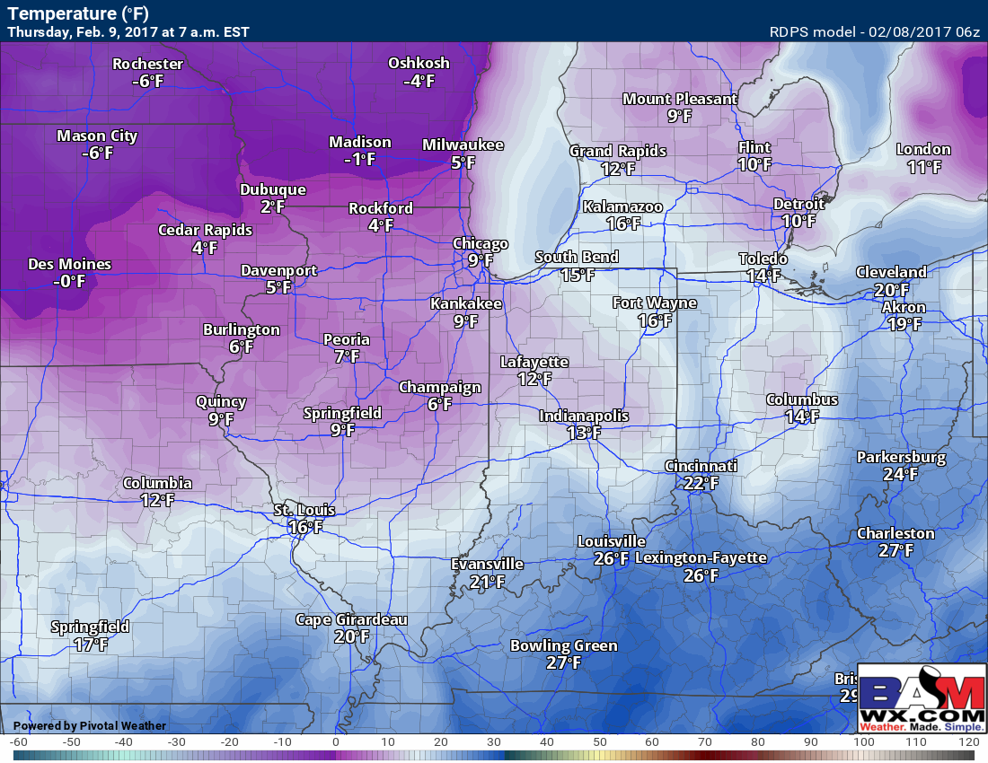
Low temps tonight…we decided to use the hi-resolution Canadian model because we believe a snowpack will drop temps into Thursday morning even lower. We have a big concern for black ice/slick surfaces to form on untreated surfaces, so we highly encourage monitoring your lots and applying treatment as necessary.
Confidence and Risk:
- Increasing confidence of an over-producing snow event moving through the Midwest today.
- Above average confidence heavier bands of snow bringing reduced visibility and slick surfaces through evening commute will be possible.
- Above average confidence in black ice/slick surfaces on untreated pavement overnight…we recommend monitoring your lots and treating as necessary.
Today’s video (7 min):