
#ILwx #INwx #OHwx Mon Short-term Update
Synopsis: Good Monday afternoon! With the impending strong to severe storms moving into the Midwest overnight into Tuesday we wanted to make sure you have the latest data available…we recommend watching the entire video as it’s another packaged forecast! We time out all the details in the video, but we continue to monitor wave #1 of strong to severe storms lifting north off of a warm front tonight into early Tuesday morning…wave #2 moves east along a cold front Tuesday morning though the afternoon with a similar risk for strong to severe storms. We wanted to mention the main severe threat from these storms will be gusty winds and isolated moderate to large hail as there will an environment conducive to strong updrafts. A few snow showers on the backside of the low pressure possible Wednesday morning, it’s here where we have concern for a refreeze scenario where temperatures dip below freezing. A second pulse of energy moves east Wednesday that we need to watch for accumulating snowfall across the Midwest…the latest European data suggests a swath of 1-2″ possible which could definitely make for some slick surfaces Wednesday night into Thursday morning. Latest data suggests lingering clouds Thursday morning but should clear late morning into the afternoon becoming partly to mostly sunny. Thanks for checking out the latest update, if you have any questions in terms of the forecast please let us know. Be weather aware!
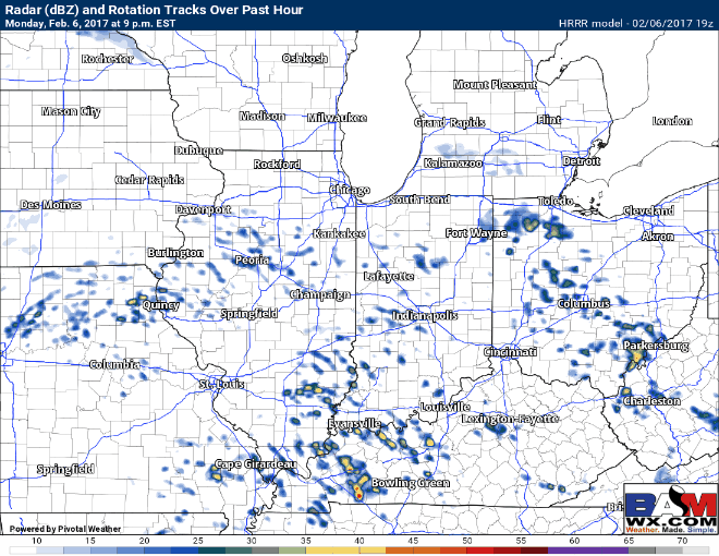
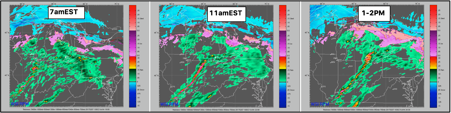
Our hi-res data suggests to watch our for storms to kick up after ~9pm tonight from south to north through early tomorrow morning off of a warm front. We are monitoring for some gusty winds and isolated moderate to large hail.
Our cold front then begins to move east tomorrow morning around the morning commute through Tuesday afternoon…similar severe threats will be possible.
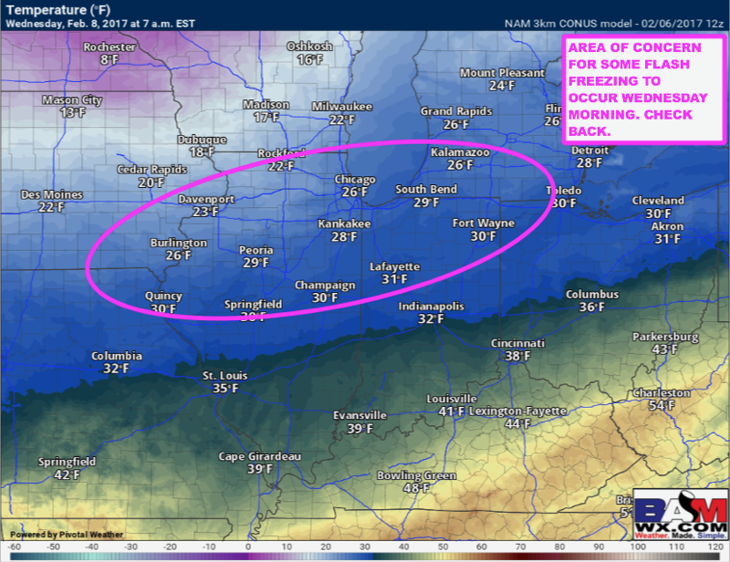
Looking at temps Wednesday morning because we have concern for some slippery surfaces where temps fall below 30ºF as shown below.
Another wave of energy moves east Wednesday that we have a growing concern for accumulating snowfall. There is some slight differences among our forecast models as to where this swath of accumulating snow will set-up, but our data has been consistent on 1-2″ possible. With that being said, not all the snow is expected to stick, but another refreeze scenario is in the cards Wednesday night into Thursday. We will have an official snowfall accumulation map posted Tuesday morning!

Temps Thursday morning will be well below freezing so any precipitation that falls on Wednesday will likely refreeze Wednesday night on untreated surfaces. We need to watch this threat very closely.

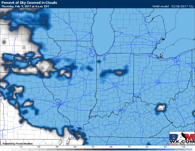
In terms of sunshine on Thursday, we will likely start out cloudy and clearing through morning hours into the afternoon as shown well below.
Thanks for hanging with us today on a longer post, but we know how critical these updates are to your operations and are willing to do whatever it takes so that you are covered. Stay weather aware tonight into Tuesday for severe storms!
Confidence and Risk:
- Above average confidence in gusty storms with isolated large hail tonight into Tuesday across the Midwest.
- Increasing confidence in a potential refreeze scenario where temps fall below freezing Wednesday morning.
- Increasing confidence of accumulating snowfall Wednesday across the Midwest of ~1-2″ looking possible at this time.
- Increasing confidence of an additional refreeze scenario Thursday morning where precipitation refreezes on contact of untreated surfaces.
Today’s video (6 min):