
Key Points – Tuesday, February 14, 2017 – next week
Synopsis: Good Tuesday morning and thanks for logging on to BAMwx.com for the latest forecast update! A few lingering showers are currently moving south and east out of the Zones this morning, otherwise today will be partly to mostly cloudy with high temps in the 40s/50s; winds will start out of the southwest and gradually move to the northwest throughout the day, gusting up to 25-30mph at times. A couple weak disturbances move south through the Midwest over the next couple of nights, a few flurries will be possible overnight into Wednesday morning along an arctic front as temps will be in the mid to upper 20s…it will be tough for these to hit the ground, however, because of dry air aloft. A similar threat is possible Wednesday night into Thursday morning with a few snow showers possible across the northern half of the forecast area…accumulations will be very minimal but a few slick spots could be possible. A mix of sun and clouds will be likely mid-week as well. We warm-up late week into the weekend significantly which is no surprise…Friday 50s and 60s, Saturday into Sunday widespread mid 60s, and the warmth even continues into next week as well. In terms of precipitation over the next 7 days is very minimal at best with a lot of dry, warm air surrounding the Midwest.
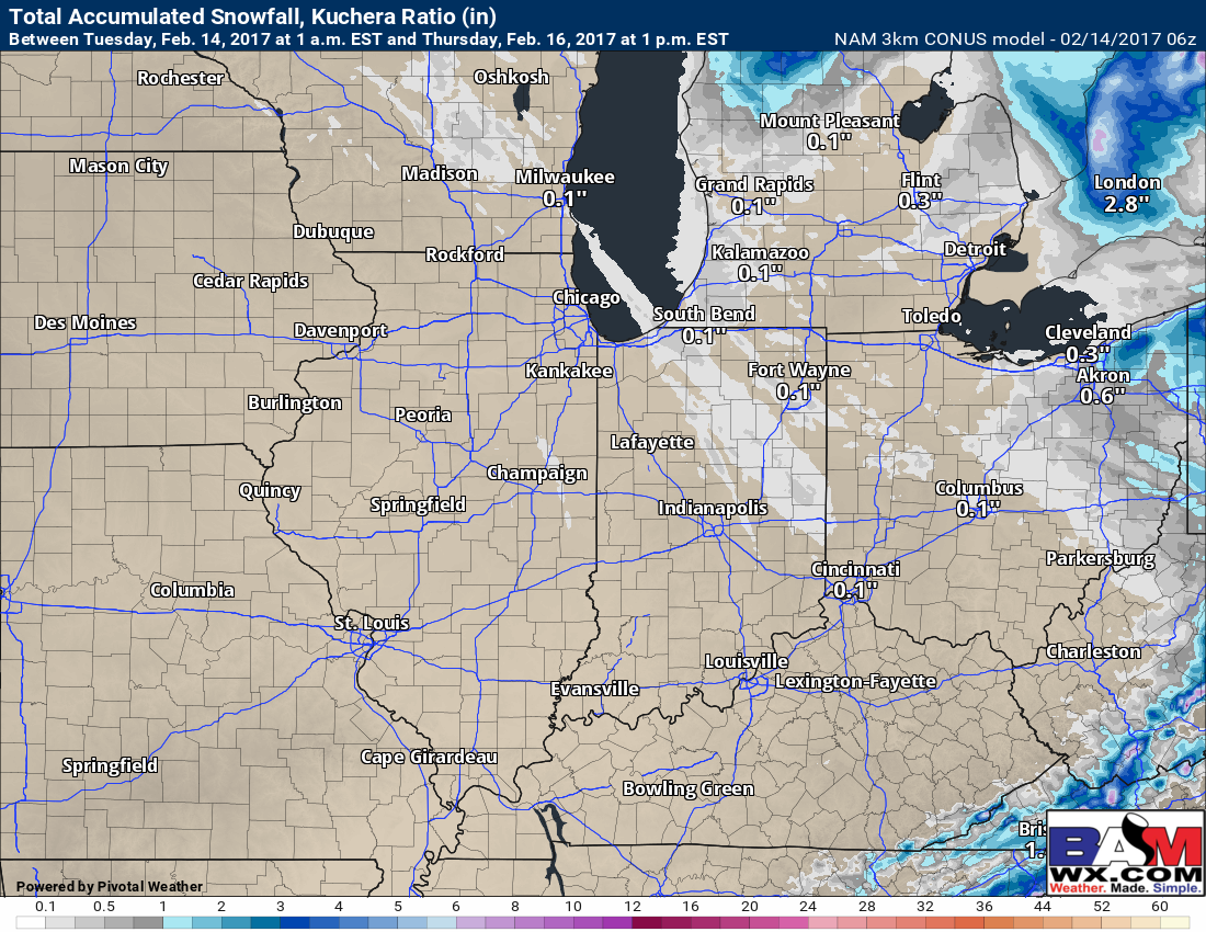
As we mention in the video, a few flurries to light snow showers possible across the northern half of our Zones overnight into Wednesday and Wednesday night into Thursday…total accumulation is minimal at best to do very dry air aloft. We can’t rule out a few slick spots, however.
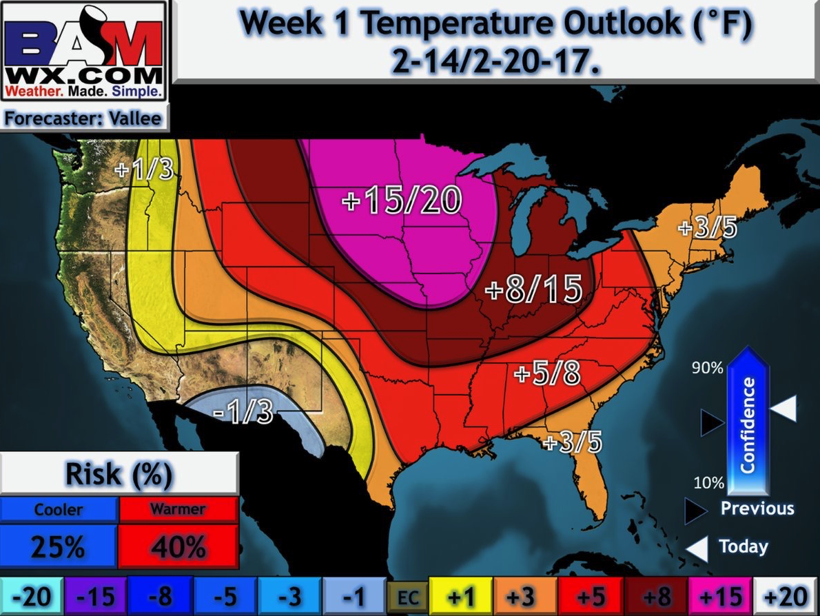
Near-record warmth returns late week, into the weekend even into next week.
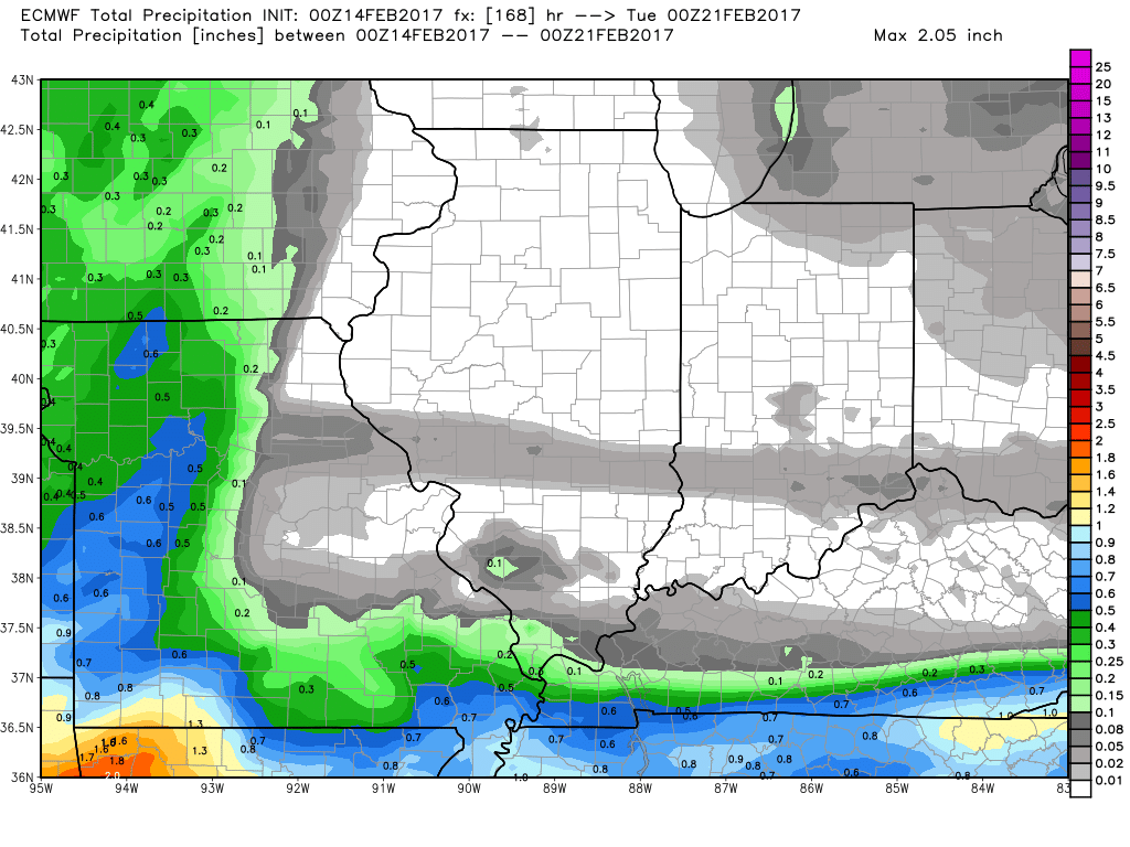
Rainfall totals over the next 7 days is minimal at best with such dry air forecasted.
Confidence and Risk:
- Above average confidence we will see a mix of sun and clouds today with mild temps…wind gusts up to 25-30 mph possible.
- Above average confidence of slightly cooler temps Wed/Thurs with a few snow flurries/light snow showers possible across the northern half of the Zone.
- High confidence above normal warmth sets in late weekend into the weekend, even into next week.
Today’s video (7 min):