
Key Points – Friday, February, 3, 2017 – next week
Synopsis: Good Friday morning and thanks for checking out the latest forecast for this weekend into next week’s weather! Definitely a chilly start today with wind chills in the single digits to teens across the Midwest…which, in all honesty, should be normal for this time of year but given how mild it’s been it feels quite cold. Radar indicates a few snow flurries hanging around the I-70 corridor as forecasted, but not much of anything likely reaching the surface due to dry air. Today we will see plentiful sunshine with highs in the 20s and winds out of the NW from 5-15mph. Our latest data still indicates unorganized energy moving west to east this weekend, but when looking at skew-ts (upper-air soundings of the atmosphere) the air is very dry and snowfall accumulation maps show virtually nothing on the ground at this time. With that being said, some pesky flurries are possible into Sunday morning before the energy pushes east. Our focus then turns to early next week and the impressive system we’ve been mentioning that is forecasted to bring gustier winds, heavy rains and even a few strong storms are not out of the question at this time. Temps also return back into the 40s and 50s Monday and Tuesday before falling Wednesday with morning snow showers possible as the low pressure moves off to the east. In terms of the long-range, our official thoughts still remain warm this month with some below normal anomalies in the northeast. A colder pattern to end February and begin March is not out of the question, more details on that in the long-range later this morning.
Latest hi-resolution model data shows mostly sunny skies forecasted for today across the Midwest, cooler with highs in the 20s and winds out of the NW 5-15mph.
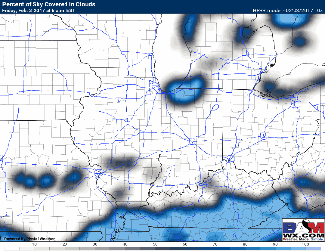
Our data still suggests unorganized energy moving through west to east this weekend, but when we look at upper-level air soundings (in the video) and snowfall accumulation forecasts we see dry air will have an impact once again. This system simply did not phase and come together, unfortunately.
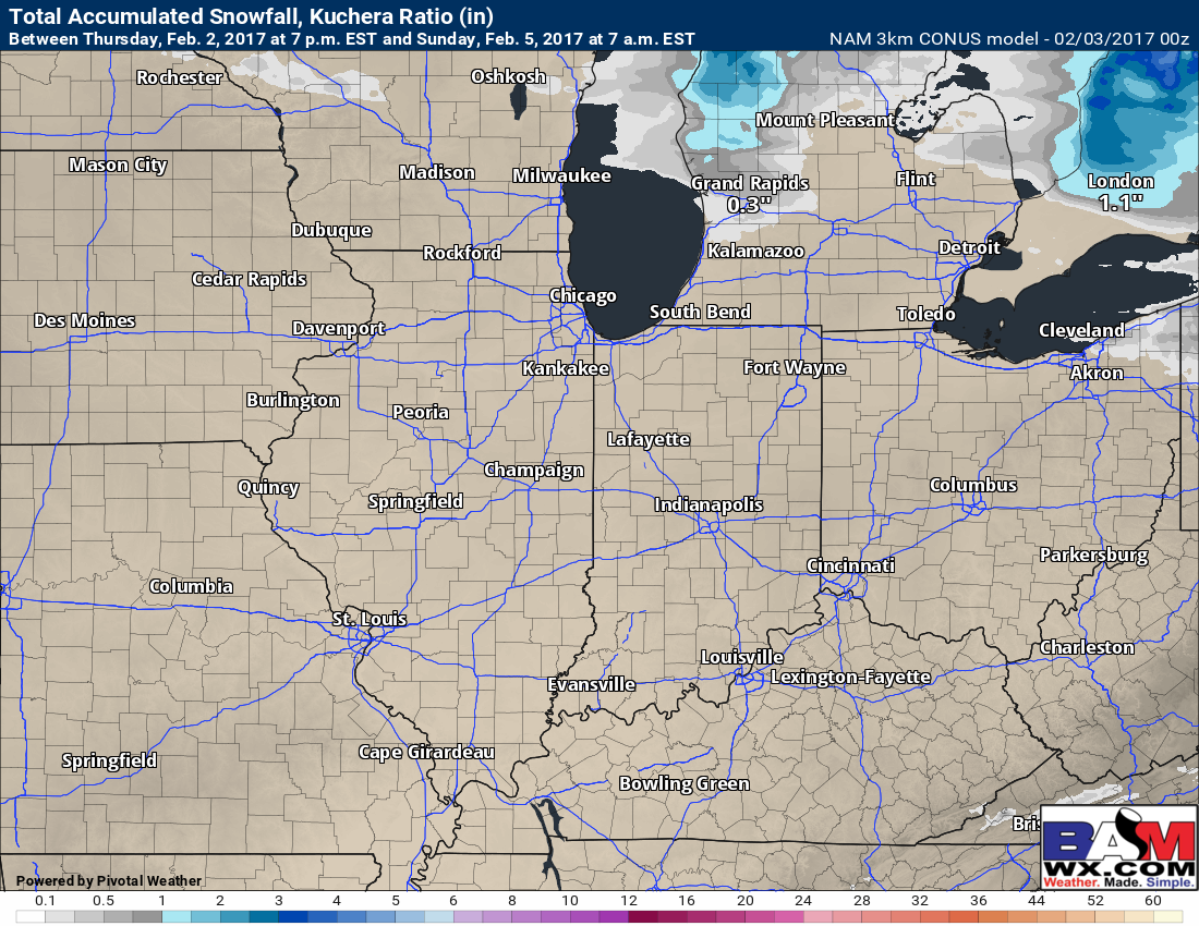
When looking at hi-resolution snow accumulation data we see nothing accumulating…a few snow flurries will be possible, however into Sunday morning.
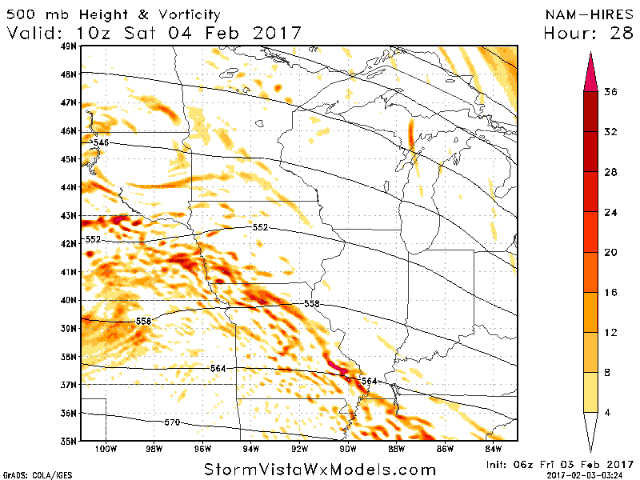
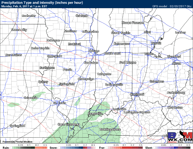
Our attention turns to the system forecasted to move through the Midwest Monday afternoon departing Wednesday that we’ve been monitoring and mentioning all week. Our latest data shows impressive moisture, upper-level dynamics and available energy that would support gusty winds, heavy rain potential and even a few strong storms possible. Simulated radar showing the progression of the system Monday afternoon/evening through Wednesday morning well from the GFS model, we discuss timing in the video.
We have impressive winds at 850mb or as we like to call them, our low-level jet stream. If we can get these winds to mix to the surface in a storm, winds 50mph+ would be possible.

When looking at CAPE or available energy (this is what we look at for thunderstorm potential), we see decent values that would support thunderstorms in the forecast Monday evening into Tuesday.

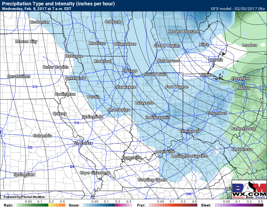
On the backside of this low pressure as it pushes off the east temperatures fall very quickly, changing precipitation over to snow showers Wednesday morning…need to monitor for a few slick spots on untreated surfaces.
Rainfall totals from the latest European forecast model, very similar values as we shared yesterday…we continue to monitor for heavier rain potential between 1-2″, localized higher amounts possible in thunderstorms that move through Monday into Tuesday.

In terms of the long-range, our official thoughts still remain warm this month overall with some below normal anomalies in the northeast. A colder pattern to end February and begin March is not out of the question, more details on that in the long-range later this morning.

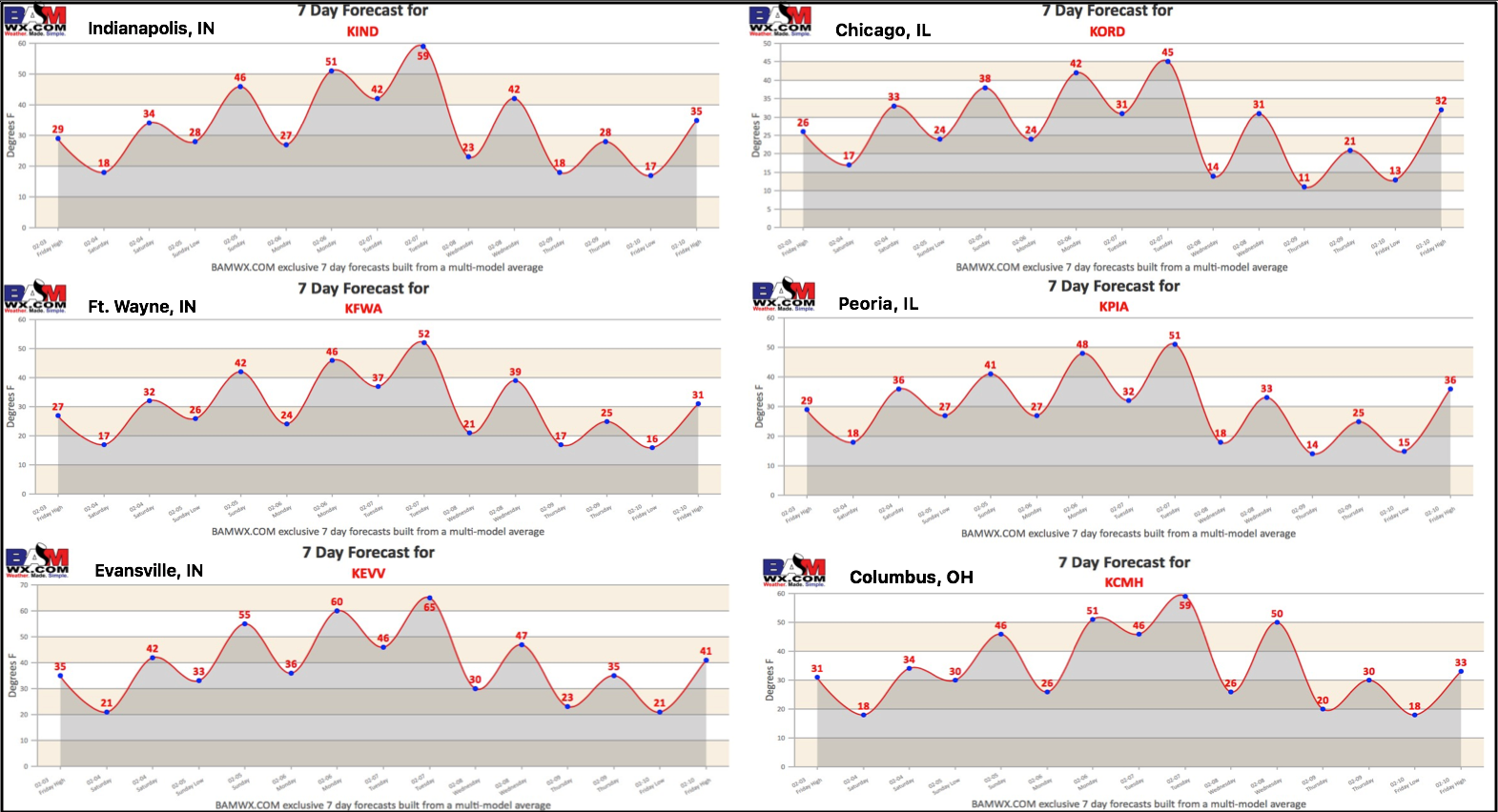
7-day forecast across the Midwest heading into the weekend and into next week:
Confidence and Risk:
- Above average confidence we see mostly sunny skies and chillier temps across the Midwest today.
- Increasing confidence this weekend system is basically a non-event due to dry air present and this system not phasing. A few snow flurries possible, however.
- Increasing confidence the system early next week has potential to bring gusty winds, heavier rains and a few strong thunderstorms.
- Increasing confidence snow showers possible on the backside of the system Wednesday morning as temperatures drop off the table.
Today’s video (6 min):