
#ILwx #INwx #OHwx Fri PM short-term
Synopsis: Good afternoon, we wanted to put out an early afternoon update with the latest data in regards to strong to severe storms tonight. A few pre-frontal showers and storms popping across Illinois into Indiana this afternoon, we do not think these will have an impact on severity of the main line later this afternoon. The main threat area for severe storms remains unchanged, expecting intensity to really pick up ~5-6pmEST eastward this evening; keep in mind, not everyone is going to get under a strong to severe storm tonight as this main line moves east. This event is basically out of the Zones by midnight tonight, backside flurries to snow showers will be possible but we are not overly concerned with any accumulations…it will be noticeably colder, however, with temperatures going from the 70s to the 30s and even some 20s.
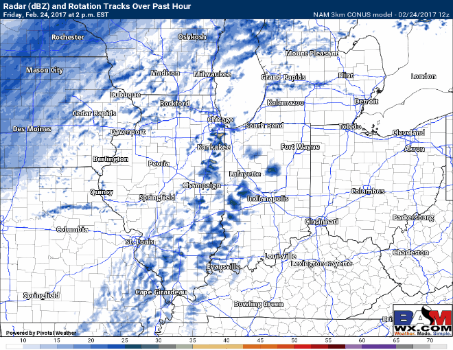
Current satellite and radar:
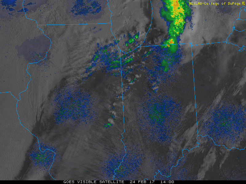
Current risk hasn’t changed…still watching for isolated tornadoes and hail if supercells can form out ahead of the main line, with a damaging wind threat following close behind.

We time everything out in the video, but expect the intensity to grow with these storms ~5-6pmEST as the line heads east.
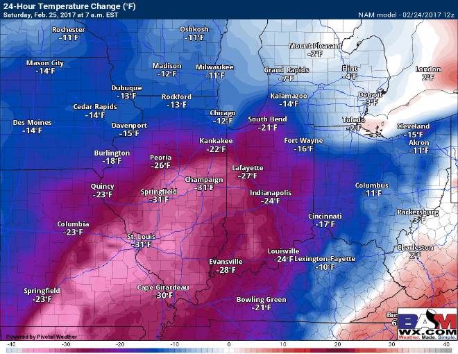
Temperature change into Saturday…still forecasting things to be upwards of 35-40º colder from this afternoon to this same time tomorrow…quite incredible, really.
Confidence and Risk:
- Average confidence on the strong to severe weather event today into tonight.
- High confidence in much colder weather moving in late tonight into Saturday.
Today’s video (5 min):