
Key Points – Thursday, February 9, 2017 – long-range
Synopsis: Good Thursday morning and thanks for checking out the latest forecast update! Today we briefly discuss the event yesterday in terms of snowfall across the Midwest, touch on the weekend rain maker that will lift north Saturday afternoon into Sunday and mild temps/windy conditions and a brief tout on the long-range pattern going deeper into Feb/March.
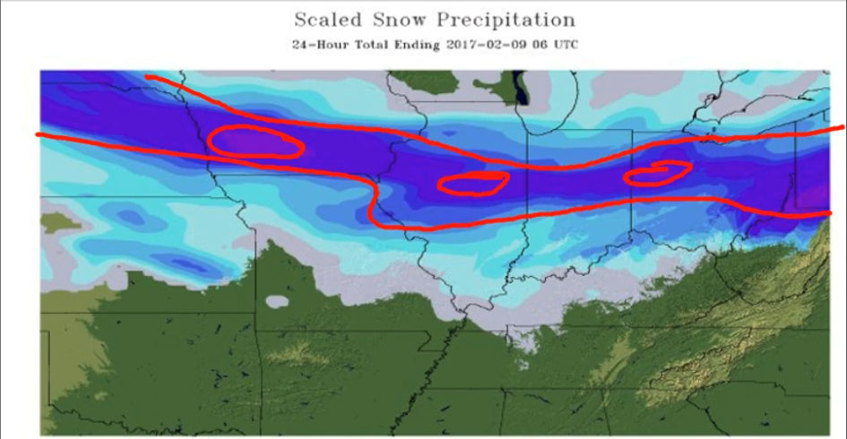
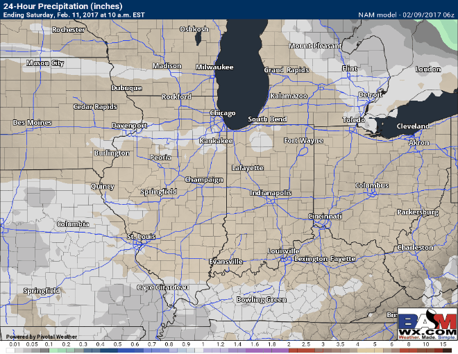
We touch on this in the video, but there’s no question yesterday’s system was an overproducer, laying down 4″+ in some spots!
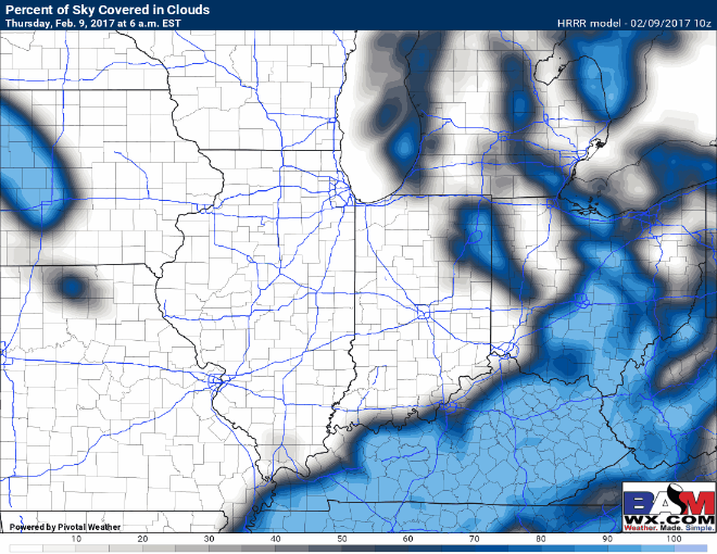
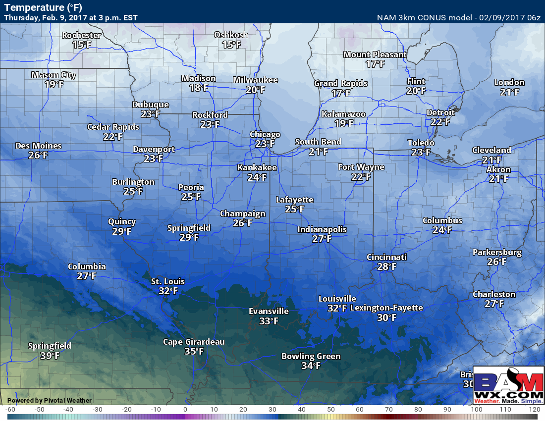
We still have some lingering flurries to snow showers across the northern half of Indiana, southern Michigan and Ohio this morning that will continue to fade away. We will see skies gradually clearing to mostly sunny skies this afternoon into the evening, chilly temperatures linger with highs not looking to get out of the 20s.
Highs today staying chilly in the 20s.
In terms of the weekend and temperatures, an aggressive warming trend sets in beginning Friday with temps in the 40s to 50s, into the 50s to 60s Saturday and then temps falling on Sunday as the cold front moves through.
We will be windy over the next 2 days, with winds gusting up to 25-30mph today and increasing up to even 35-40mph in the weekend. Winds will start out of the NW today progressively moving into the south to southwest into Saturday.

As mentioned in the synopsis, another pressure system moves in Saturday afternoon into Sunday bringing pesky showers. Total amounts should range between 0.1-0.25″ out of this, the GFS does suggest slightly higher amounts into Ohio but confidence is lower on that right now given the setup.
New JMA weeklies came out today, we continue to see the warming trend through week 2 digging deeper into February, active as well. What’s really interesting is to see the JMA picking up on the cooler trend to end February and usher in March as we’ve been discussing for weeks now. We continue to connect the dots with our organic forecasting methods in regards to how March looks to shape up…cooler times ahead? We shall see! Thanks for tuning in today, have a great day!
New JMA weeklies show a wet and cooler trend to end February and usher in March.
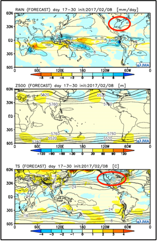
We continue to see a similar trend when using our organic forecasting methods as seen below…obviously this is outside the box thinking, but given how well this has performed this season it’s very hard to ignore at this point.

Confidence and Risk:
- Increased confidence today is chilly with skies clearing to mostly sunny by the afternoon.
- Above average confidence the next 2 days are windy with gusts up to 30-40mph at times.
- Increasing confidence we see pesky rain shower Saturday evening into Sunday before clearing to the east.
- Increasing confidence of a continued warmer/active pattern over the next 2 weeks, but are starting to see data now picking up on a cooler trend to end February/begin March.
Today’s video (5 min):