
Key Points – Thursday, February 23, 2017
Synopsis: Good Thursday morning, let’s dive right into the forecast as there’s much to discuss in today’s update! We are starting out the day fairly clear across the Midwest this morning, clouds will increase as the day progresses…expecting temperatures to rise into the 60s widespread as well. We continue to watch a warm front lifting into the Ohio Valley from I-70 north by around 3-4pmEST today into the evening…some of our hi-res models are picking up on thunderstorms as well with some small hail possible. An Enhanced Risk is still issued by the Storm Prediction Center for Friday, the threat has expanded slightly east as we mentioned would be likely in yesterday’s forecast update. The key here is going to be cloud cover in regards to the severity of these storms, the sunnier it is the greater the severe threat…we have all of the dynamics we need. The hazards remain unchanged in this order: damaging winds, hail and even tornadoes will be possible. We start seeing thunderstorms Friday afternoon by ~4pmEST moving west to east across Eastern Illinois…we are concerned for a pre-frontal line of storms out of ahead of the cold front ~6-7pmEST that we are concerned for a tornado threat in a round of supercells with a line of thunderstorms (the cold front) right behind these. All modes of severe weather cross into the western Ohio ~10pmEST and shifts east through the overnight. This is something to take very seriously, if we receive enough instability on Friday we wouldn’t be shocked for the risk to be upgraded even further. Temperatures will feel like winter as the low pressure departs east on Saturday, dropping from the 60s/70s to the 30s even a few 20s. Latest look at the new JMA weeklies shows a very active pattern over the next 28 days with more opportunities for severe weather as well. Stay tuned!
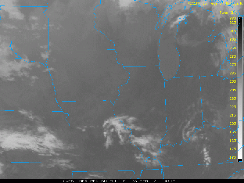
Latest glance at satellite across the Midwest this morning…clouds increase throughout the day but some sunshine will still remain possible as we go forward.
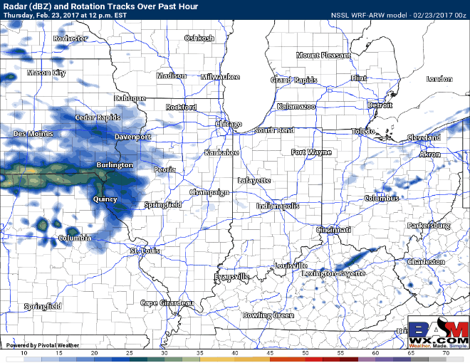
We continue to watch a warm front lifting into the Ohio Valley from I-70 north by around 3-4pmEST today into the evening…some of our hi-res models are picking up on thunderstorms as well with some small hail possible.
Our thoughts on where the best location for severe weather Friday remains largely unchanged, we mentioned yesterday we wouldn’t be surprised to see the SPC expand their risk area slightly further east, which is exactly what has occurred this morning as seen below. This is something to take VERY seriously, as all modes of severe weather are on the table right now.

The thing that hinges everything in terms of the “severity” of this threat on Friday is how much sunshine we receive to fuel these storms. As we’ve discussed in prior posts, the more sunshine (energy/CAPE/instability whichever term you prefer) the higher likelihood for damaging winds, hail and isolated tornadoes. If cloud cover persists on Friday morning into early afternoon, this could greatly hinder how strong these storms are capable of becoming. You can see below that we do have data that suggests sunshine will be present, so our concern continues to grow for all modes of severe storms on Friday afternoon into the evening.
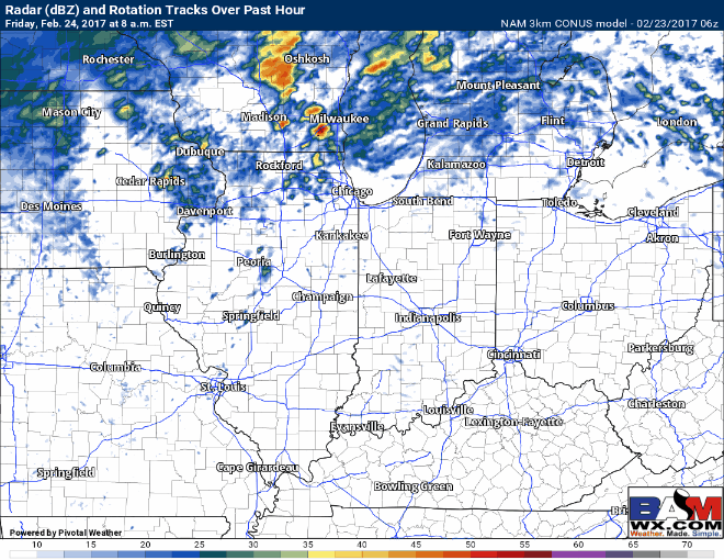
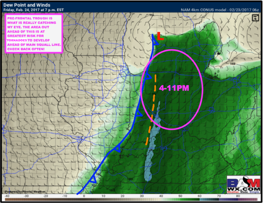
We start seeing thunderstorms Friday afternoon by ~4pmEST moving west to east across eastern Illinois. We are monitoring for a pre-frontal line of storms out of ahead of the cold front ~6pmEST cross east into Indiana that we are concerned for a tornado threat in a round of supercells, with a line of thunderstorms (the cold front) right behind these. All modes of severe weather cross into the western Ohio ~10pmEST and shifts east throughout the overnight.
This is the area we are focusing most intently on for the greatest risk for tornadoes to develop ahead of the main squall line on Friday.
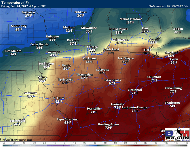
Below is a great animation of the major temperature swing that will occur from Friday into the weekend…we go from 60s and 70s to 30s and 20s in a matter of 24hrs or less. Or in other words, we go from spring back to winter for a short period of time.
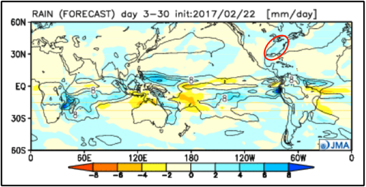
Brief touch on the long-range via the new JMA Weeklies shows a very active pattern over the next 28 days with continued chances for severe weather in between as well. We recommend watching all of the updates going forward as we will have much to discuss! Have a great day.
Confidence and Risk:
- Increasing confidence cloud cover increases throughout the day today, although some sunshine still looks to be possible.
- Above average confidence in the timing of the showers and storms along the warm later on today, a few reports of small hail are possible as well.
- Increasing confidence we see some additional sunshine Friday morning into the afternoon, which would intensify our severe weather threat.
- Increasing confidence in the timing of our strong to severe storms along and out ahead of the cold front later on Friday…right now all modes of severe weather are on the table.
- High confidence we see major temp differences Friday into Saturday as the low pressure departs east…going from spring to winter in 24 hours.
- Increasing confidence of a very active pattern over the next month into March.
Todays’ video (7 min):