
Key Points – Tuesday, February 7, 2017 – weekend
Synopsis: Good Tuesday morning and thanks for checking out the latest forecast update! Another warm start this morning with widespread temps in the 50s/60s ahead of the cold front. Our first wave of showers and thunderstorms continues to lift north along the warm front, our second wave of storms will push east through the morning into the afternoon along the cold front. Our main threats for storms along the front will gusty winds, isolated hail and heavier rains (a lot of this depends on the amount of sunshine we receive today to fuel these storms). As the cold front moves through today we need to watch watch for some slick surfaces that are untreated where temps fall ~30ºF or lower as we outline below. Our long-discussed wave of energy moves east on Wednesday as well that we are watching closely for accumulating snow…we need to monitor this for being a potential over performer because of such a strong upper level jet stream forecasted to be 120+knots. Current thoughts continue to be 1-2″ right now as discussed in the video. Thursday morning we are even more concerned with more widespread slick surfaces/black ice that are untreated as temperatures Wednesday night into the day Thursday continue to drop well below freezing. Thursday/Friday remain fairly quiet as high pressure lingers across the Midwest, it’s Saturday into Sunday where we have another interesting set-up that honestly has similar characteristics to the system moving through today; confidence in additional showers and storms from a warm front and cold front continues to grow, we will have more updates on this as the week progresses.
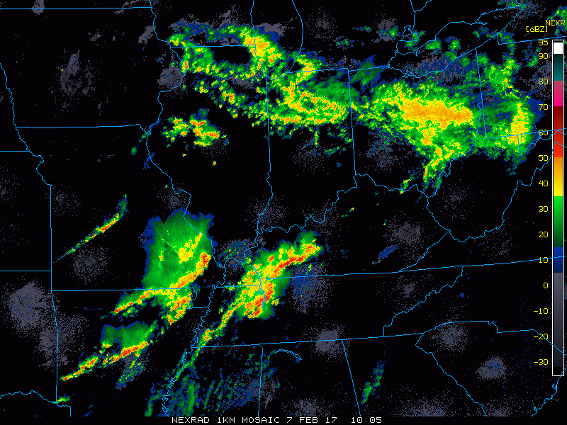
Current glance at radar across the Midwest this morning:
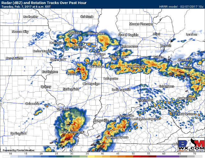
Latest hi-resolution simulated radar shows the additional storms well throughout the morning into the afternoon moving east along the cold front well…isolated hail, gusty winds and heavier rains will be possible. We time these out in more detail in the video.
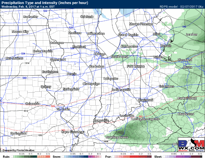
As the front passes today, temperatures fall quickly on the backside…below is where we are concerned for some slick surfaces/black ice Wednesday morning where temps fall below 30ºF.

Snow showers return in the forecast Wednesday morning through the day, accumulations right now hovering between 1-2″ with localized higher amounts possible…we are monitoring for this system to possibly overperform given how strong the upper-level jet is to be forecasted 120+knots as this wave moves through.
BAM current snowfall accumulation map…1-2″ is the overall forecast. We did add a dashed line of 2-3″ possible with low confidence at this time…an impressive upper-level jet is forecasted to move through which could enhance snow showers/accumulation amounts.
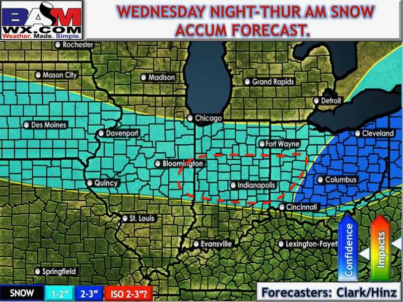
Here’s the “meteorology” behind what we refer to as this system having the potential to over perform. The blue circle represents where the upper-level jet stream exits, this is the same area where lift is the greatest…simply put this region could enhance snow showers and increase snowfall accumulation. The 2-3″ is a low confidence mention right now, we will continue to monitor the trends today and update as necessary.

We have a growing concern for additional slippery surfaces/black ice on untreated pavement Thursday morning as temperatures drop well below freezing as the arctic front pushes through Wednesday night into Thursday…temps on Thursday will remain in the 20s.

Cloud cover on Thursday will shift from mostly cloudy in the morning to clearing late morning into the afternoon/evening; partly to mostly sunny skies expected especially in the second half of the day.

Watching for another wave of showers and storms this weekend with a similar set-up as to what’s moving through today…will be monitoring this as we go forward this week.

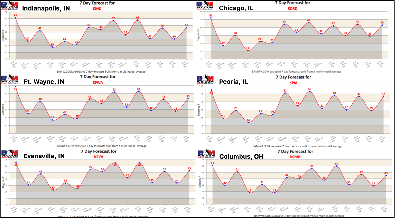
7-day forecast around the Zones…you can access more cities by going to https://bamwx.com/7-day-forecast/:
Confidence and Risk:
- High confidence additional showers and storms (strong?) moving east today along a cold front.
- Above average confidence temps fall tonight into Wednesday morning, slippery surfaces/black ice possible where temps fall below 30ºF.
- Increasing confidence a swath of 1-2″ of snowfall accumulation possible on Wednesday.
- Increasing confidence more widespread slick spots possible as temps plummet into the teens to 20s Thursday morning.
- Increasing confidence another system bring showers and storms look likely Saturday into Sunday this coming weekend.
Today’s video (6 min):