
Key Points – Tuesday, February 21, 2017
Synopsis: Hey there and good Tuesday, thanks for checking out the latest forecast update! Today we discuss the remaining showers moving east across the Zones along a weak frontal boundary, there will be clearing behind the showers as they pass especially for Illinois locations…it will be another warm day as well with temps rising into the 60s and even a few 70s will be possible. Wednesday remains warm and dry, we are however watching for some patches of dense fog/drizzle to develop tomorrow morning across portions of the Midwest. We still continue to monitor for showers and a few storms lifting north off of the warm front Thursday evening into the overnight and stronger storms possible on Friday as a cold front sweeps east on Friday…some backside snow showers are possible as well as the strong low pressure moves east. New Euro Weeklies came out last night with a very wet and stormy look over the next month and a half…we touch on all the details in the video, have a great day!
Latest glance at radar across the Midwest shows a line of showers slowly progressing east off of a weak frontal boundary.
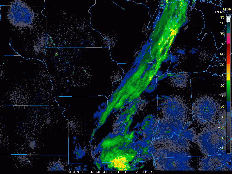
We time out the remaining showers in today’s video, a few rumbles of thunder are not out of the question this afternoon as well as there is some energy present south of I-70. Skies begin to clear as the showers move east as so some sunshine will be possible.

We mentioned in the synopsis also there is a risk for some dense fog/drizzle tomorrow morning, this is shown well by the RPM model below, the darker shades of red indicate reduced visibility. It’s something we will need to monitor throughout the day and discuss in a short-term update later if necessary…but confidence is increasing on this. Skies begin to clear on Wednesday as the fog lifts allowing for additional sunshine and warmth.

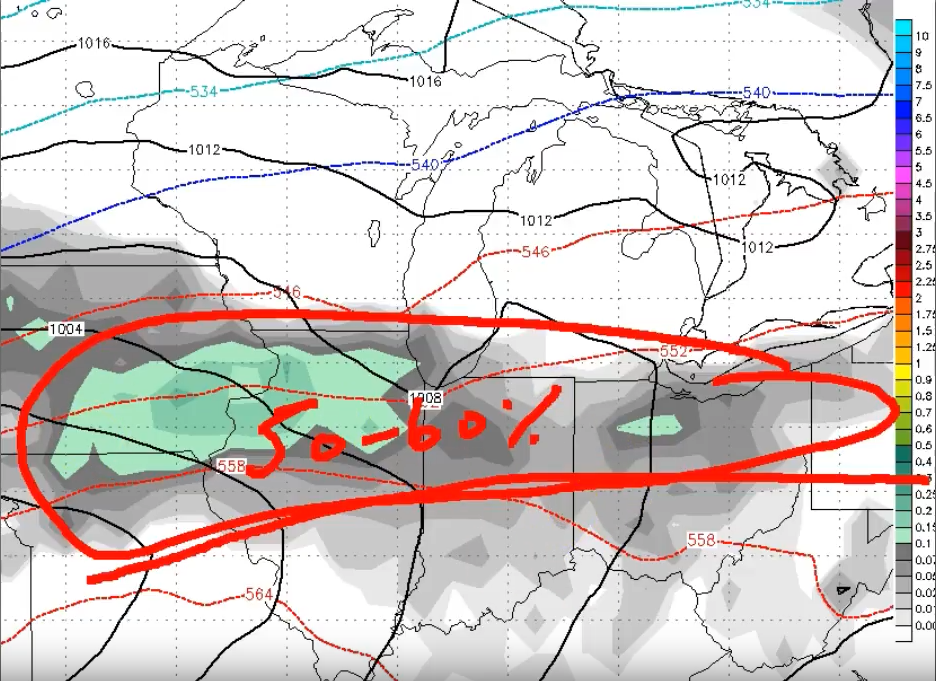
The first half of Thursday remains rather uneventful, even some sunshine possible…a warm front lifts north later in the evening on Thursday however, increasing the threat of showers and even thunderstorms (higher coverage possible across Zones 3/4). We still have a concern for strong storms on the day on Friday as a cold front is forecast to sweep west to east. The question we need to ask ourselves is, what can cause these storms to not reach “severe” criteria? We’ve seen in many scenarios where we’ve had a lot of wind shear (change in wind direction/speed with height) but low CAPE (energy – think sunshine). Now, with that being said, damaging winds and hail would still remain a threat, but it could limit potential for a tornadic environment. If we receive more sunshine on Friday, things could change…it’s a scenario that’s still unfolding and needs watched closely.
Showers and some storms lift north with the warm front Thursday evening, coverage likely 50-60% especially across Zones 3/4.
Friday’s severe weather threat is largely dependent on how much energy we receive during the day…the more we receive, the more likely our storms turn strong to severe, the less energy and you figured it out…the more likely these storms are to stay below the severe threshold. It’s a scenario that is still fluid, so stay tuned.

New Euro Weeklies came out last night are very wet over the next month and a half, as well as active with plenty of severe weather potential in the cards as well.

Confidence and Risk:
- Above average confidence showers continue to trek east today, a few rumbles of thunder south of I-70 possible as well later this afternoon.
- High confidence temperature remain well above normal the remainder of the work-week.
- Increasing confidence of some patchy dense fog developing across the Midwest Wednesday morning.
- Increasing confidence of strong to severe storms on Friday…largely dependent on how much sunshine (energy or CAPE) we receive during the day.
- Increasing confidence of a very active and stormy look over the next 46 days from the latest Euro Weeklies.
Today’s video (time):