Good Morning all!
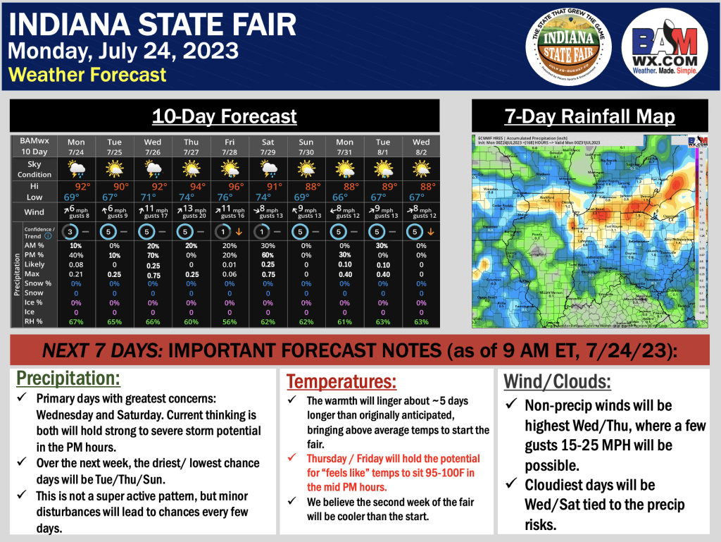
We wanted to provide the latest forecast thinking for the week here as we draw toward the start of the fair. Since our last long range forecast discussed a few weeks ago – data has slowed the departure of the warmth some, leading to heat lingering around the area a few days longer than originally anticipated.
As things stand now, the best precip risks will come into play Wednesday PM and Saturday, both of which hold strong to severe storm risks (primary concern will be gusty winds). The other thing to carefully watch are Thursday / Friday heat index values (more on the forecast slide below). We will continue to update as we work deeper into the week – please do not hesitate to reach out with any questions!
