
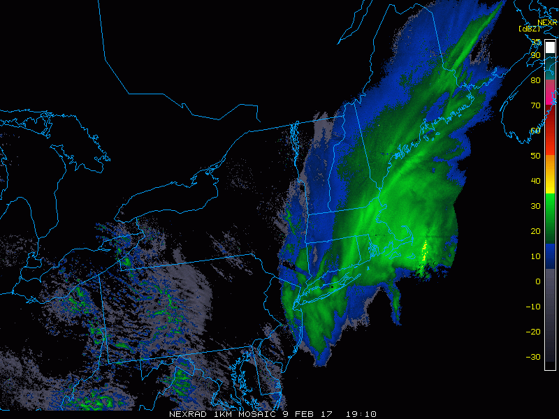
Good afternoon – last snowstorm update for this storm and what a storm it’s been! Many reports of 15-18″ of snowfall from the Hudson valley through northern Massachusetts with this one and it’s still coming down for some! Here’s the latest radar as of 4:10 PM.
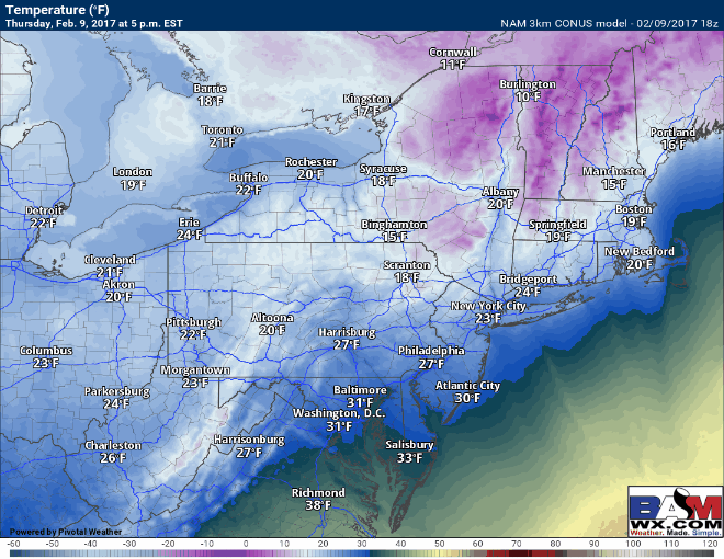
Temperatures are cold across the region, but as snow winds down between now and 8pm from west to east, some icy spots will develop as things refreeze. Here’s a look at the temperature forecast from this evening through the overnight.
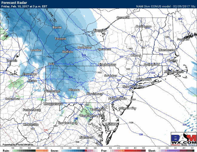
More snow is looking likely tomorrow afternoon through tomorrow as a quick moving disturbance swings through. Here’s the projected radar via the 3km NAM. Light snow will wind down early Saturday morning from northwest to southeast.
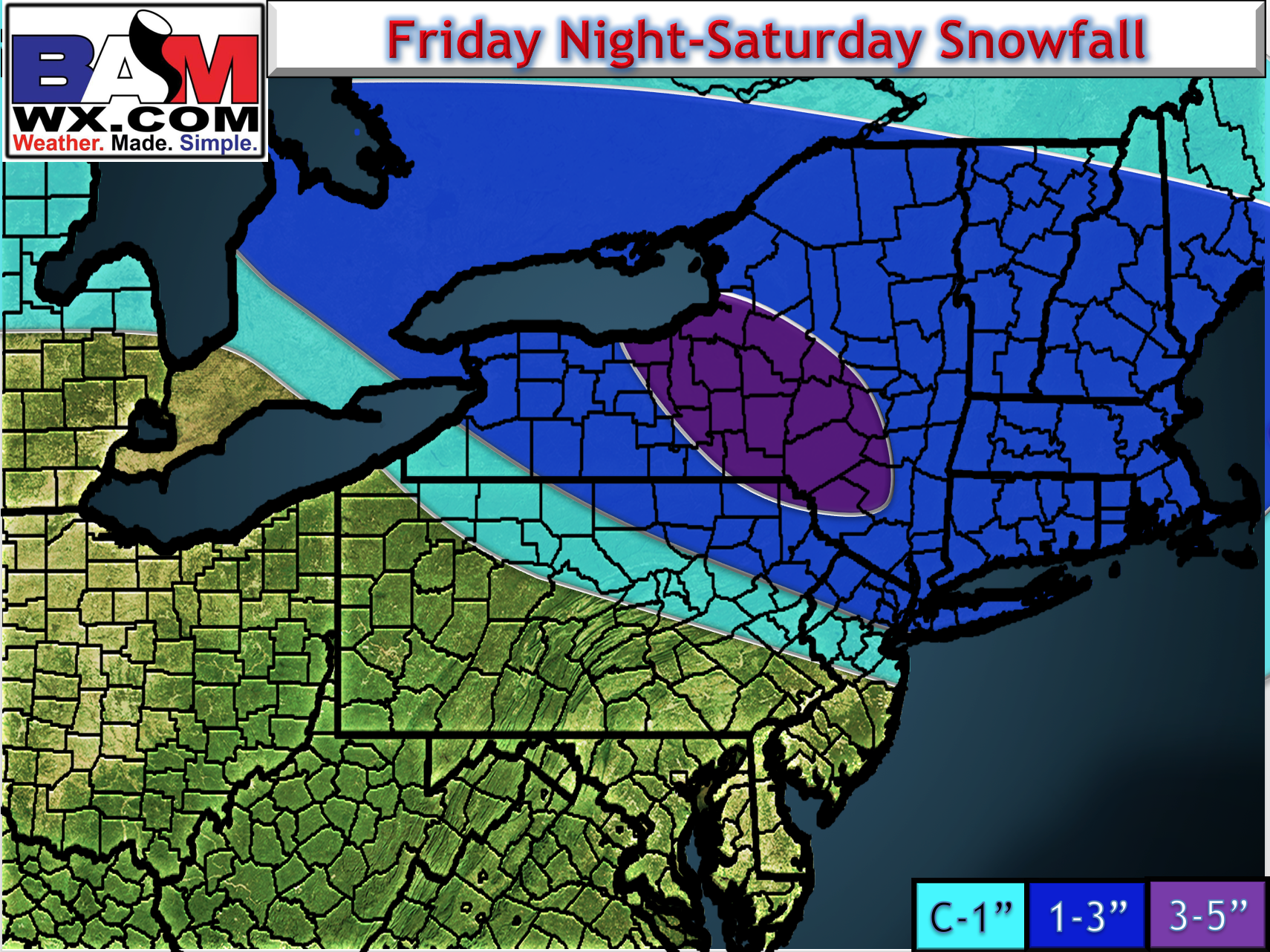
Here’s my thinking for total snowfall – a general 1-3″ for northeast PA, NYC, and southern New England.
I’ll have a full update tomorrow morning with a video and updated maps. Have a wonderful night! ~Ed