Today’s video (7 min):
Wind advisories being hoisted already this morning for strong wind gusts as the low pressure nears the Ohio Valley…these likely expand as we go throughout the day; gusts topping 45-50mph can’t be ruled out, especially north of I-70:

Simulated radar guidance regarding the rainfall moving west to east later this evening into Tuesday morning…the best timing for showers and a few storms is ~7pm Monday to 7am Tuesday.
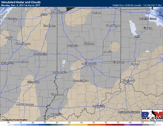
Total rainfall guidance with this system…we think totals south of I-70 could overachieve a bit…can’t rule some areas seeing 0.75-1″ out of this before it’s all said and done; locations north we favor ~0.1-0.2 and closer to I-70 ~0.3-0.5″.

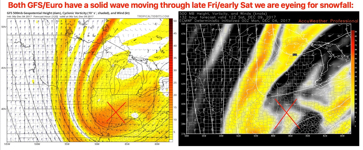
We continue to watch Friday night into Saturday for a solid wave of energy to work in from west to east along a trough…confidence on specifics regarding accumulating snowfall numbers is low, however, confidence is above average that snowfall will be possible:
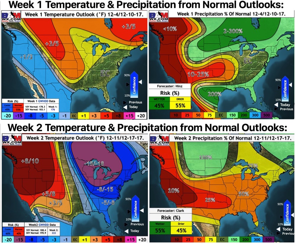
Updated weeks 1 and 2 long-range outlooks…turning sharply colder into the weekend/next week: