Video (5:00):
Good Wednesday afternoon.
We’re targeting a system that has the potential to produce accumulating snowfall on Friday night.
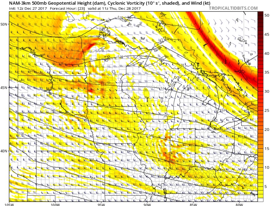
First, a weak disturbance could bring flurries or a scattered light snow shower tomorrow morning, especially in the central and southern part of the state. These chances show up well on the upper-level vorticity map. The big concern for this potential is the abundance of dry air in the atmosphere.
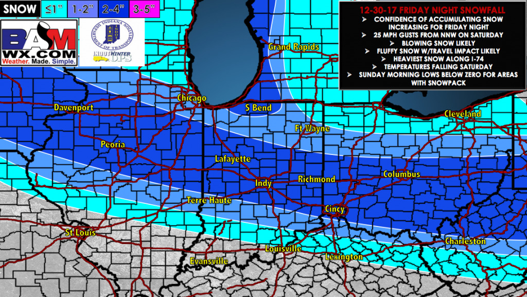
For Friday, snow will likely begin in Western Indiana in the evening and continue into the overnight hours. Snow showers will continue into Saturday morning but end by mid-day with a few peaks of sun in the afternoon. Models have converged on a solution that depict a somewhat narrow snow shield impact the state. As of right now, we believe the heaviest snow will fall along I-74 throughout Central Indiana including Lafayette, Indianapolis and Richmond. There could be a sharp cutoff to the south leaving southern counties mostly dry.
Temperatures will be in in the upper-teens and low-20s for the southern half of the state early on Saturday. However, as the arctic air mass advances south, temperatures will drop quickly throughout the day with wind gusts from the NNW of 25 MPH. This could create hazardous driving conditions with blowing snow. Sunday morning temperatures will likely be below zero in areas with a snowpack on the ground.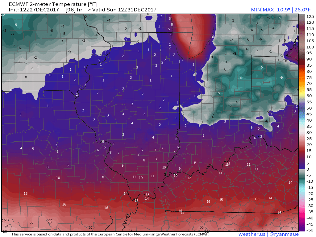
Overall, here is our current thinking for snowfall and impacts. Be sure to reach out if you have any questions and have a great Wednesday.