Video:
Good Wednesday morning everyone. We are tracking out several chances of snow into next week and the timing on the next blast of arctic air.
As we discussed yesterday, models were once again well too warm for morning low temperatures across the Northern Plains. Temperatures, as of 5AM CST are well below zero over the entire region. 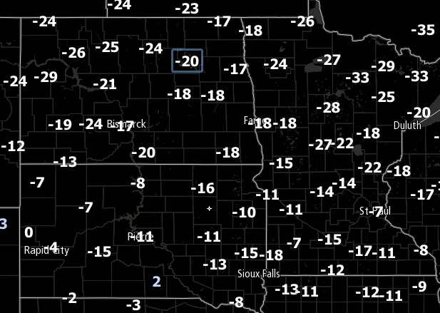
We will moderate a bit today as a piece of energy deepens to the west and draws in some “warmer” air. 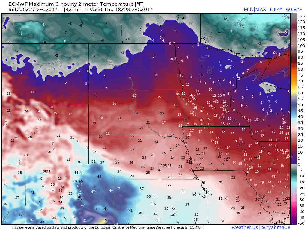
Two separate areas of energy will be responsible for light snow accumulations later today and into tonight. If you take a look at the simulated radar beginning late this afternoon, you can see snow beginning to develop in Western North Dakota and then snow showers developing slightly later in Eastern South Dakota and Southern Minnesota. These pieces of energy will congeal and form a more defined snow system by tomorrow morning which will allow for the highest accumulations to occur in Minnesota and Eastern North Dakota. 
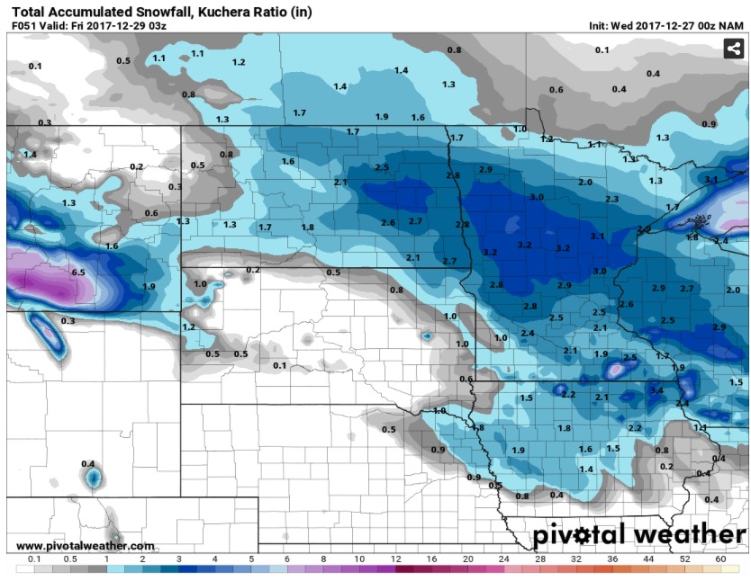
Additional waves will produce snowfall accumulations on Friday and into Saturday Night, this time focusing primarily on South Dakota.

The Canadian Model has been very consistent over the past five runs, with the entire region seeing more than 2 inches by Sunday night. As of now, South Dakota looks like the bullseye for snow for the next week, with Minnesota and North Dakota receiving the majority of their snowfall tomorrow.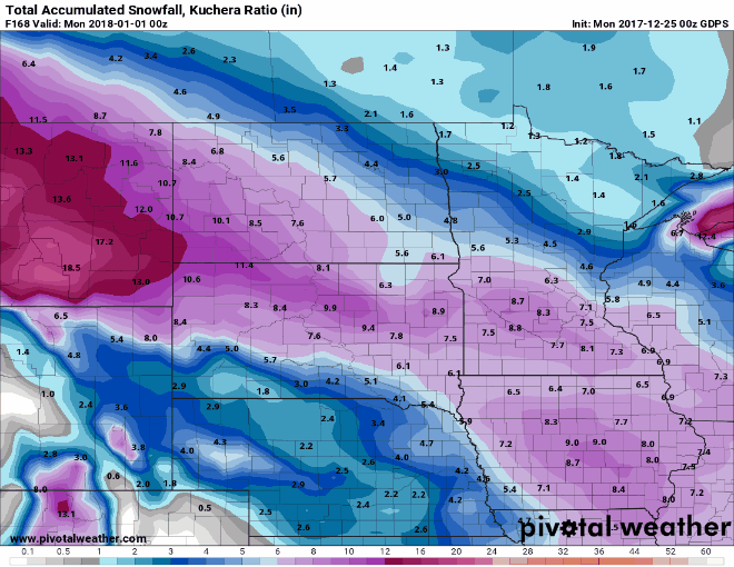
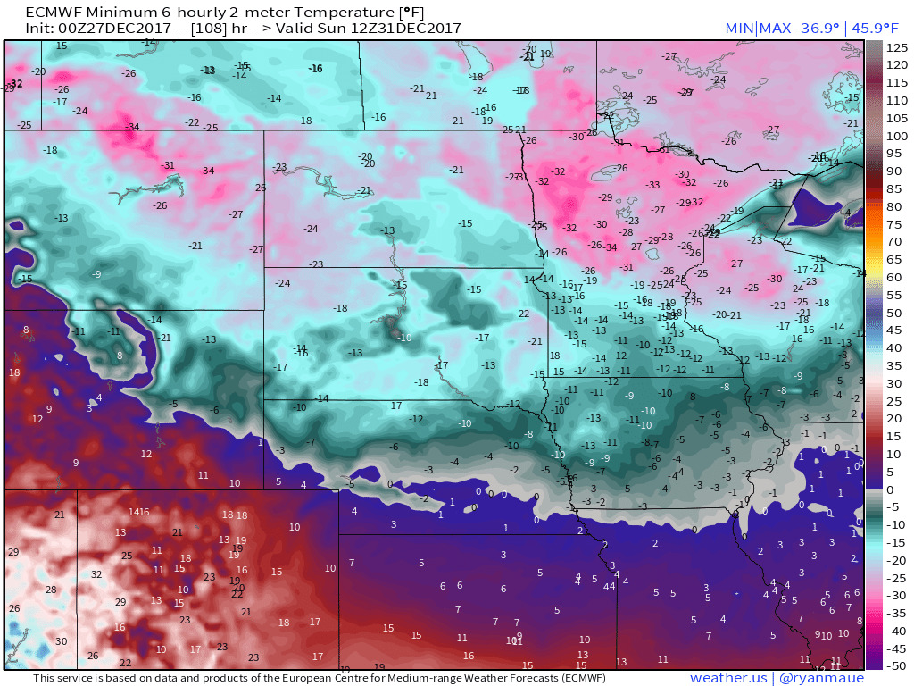
Behind the final waves of snow, the arctic air mass will settle back into place for the end of this year and into the new year. Widespread temperatures of below -20 are possible for New Years Eve morning.