
Video:
Good Wednesday everyone!
We are tracking multiple bouts of accumulating snow over the next few days due to a consistent stream of energy through the Central Plains.
The first chance for accumulating snow will be this evening into tonight in Eastern Nebraska and much of Iowa. Here’s the simulated radar from the hi-resolution NAM showing this chance. It is also picking up on another quick hitting impulse that will affect Iowa on Thursday Afternoon.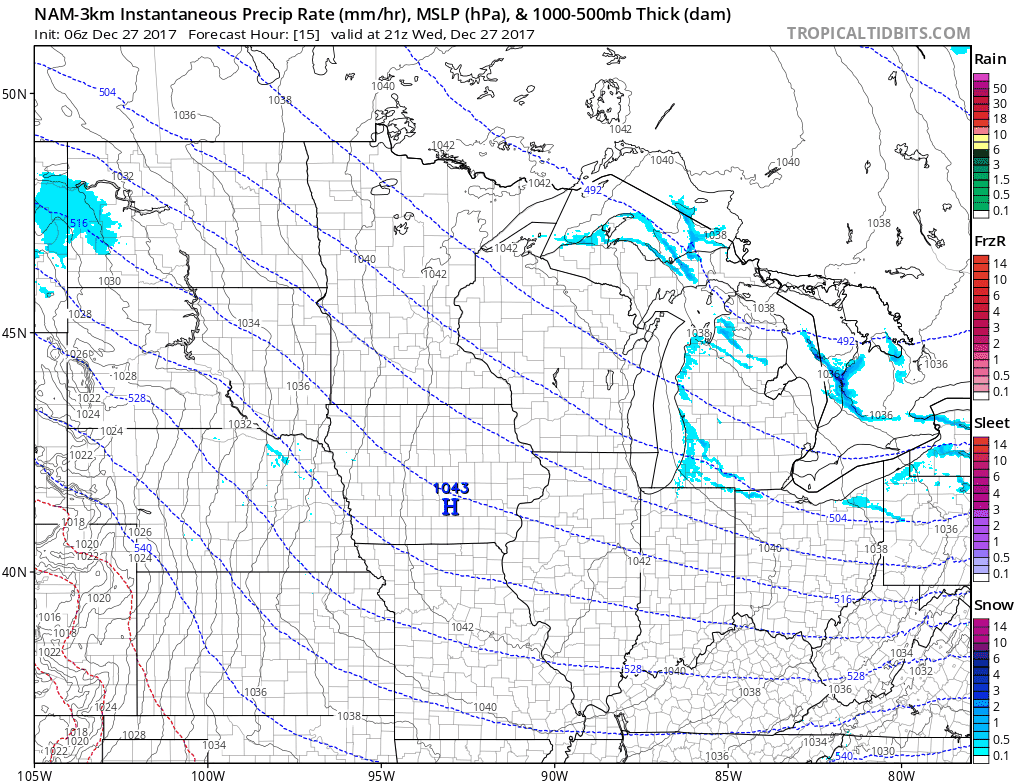
There will be a brief dry period Thursday night, but a another piece of energy will allow for a solid swath of snow to develop over the area on Friday. This will also allow for some “warmer” air to be drawn in and temperatures will reach upper-teens and low-twenties for most of the state Thursday.
 As of now, models are wanting to put the heaviest part of this swatch through Central Iowa and Northern Nebraska. Here’s a look at the forecasted accumulated snowfall from the Canadian by Saturday Morning.
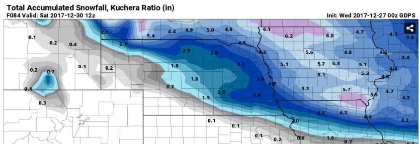
With a solid snowpack in place for both Nebraska and Iowa, early morning temperatures will be below zero for most of both states Sunday, Monday and Tuesday mornings. Here’s a look at the forecasted temperatures on Sunday Morning from the European Model (who has been running several degrees to warm in areas with a snow pack):
Be sure to stay warm and, as always, do not hesitate to reach out if you have any questions. Have a great Wednesday!