
Video (5:00):
Good Tuesday morning everyone. Hope you had a wonderful Christmas. We are tracking several waves of energy that will produce snow chances throughout this week.
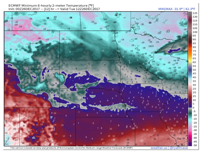
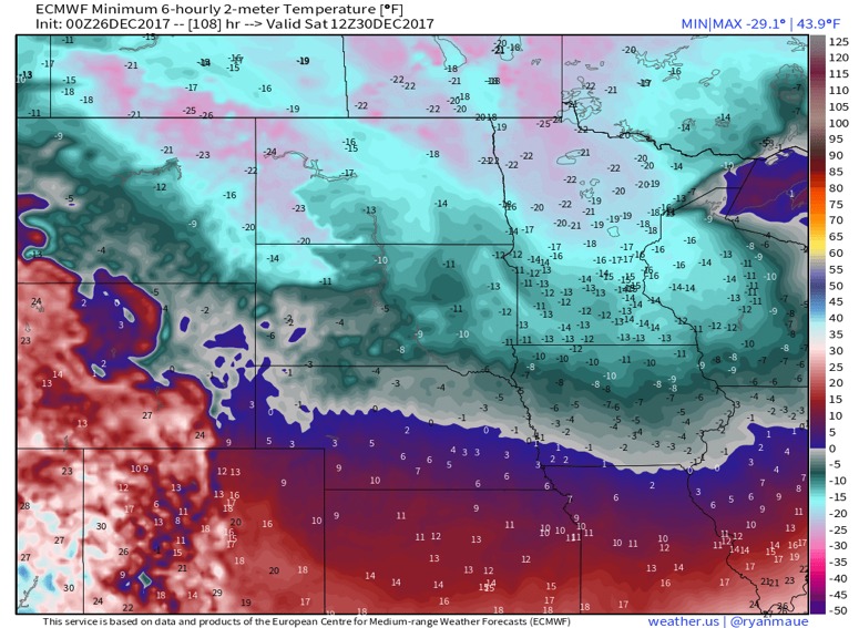
Outside right now temperatures are well below zero throughout the region. Models are busting on overnight temperatures with a solid snow-pack down in most of North Dakota and Minnesota. Overnight lows from the European model were about 10 degrees too warm in most areas with last nights overnight lows.
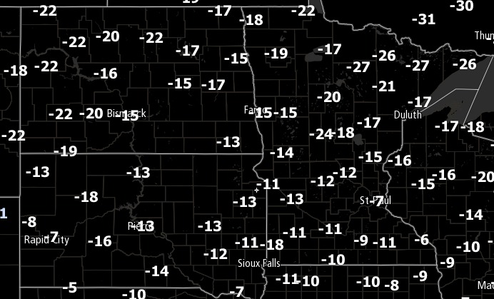
With this in mind, morning temperatures will likely be similar tomorrow to what they are today and with winds at 5 to 15 MPH wind chills will be dangerously cold tomorrow morning.
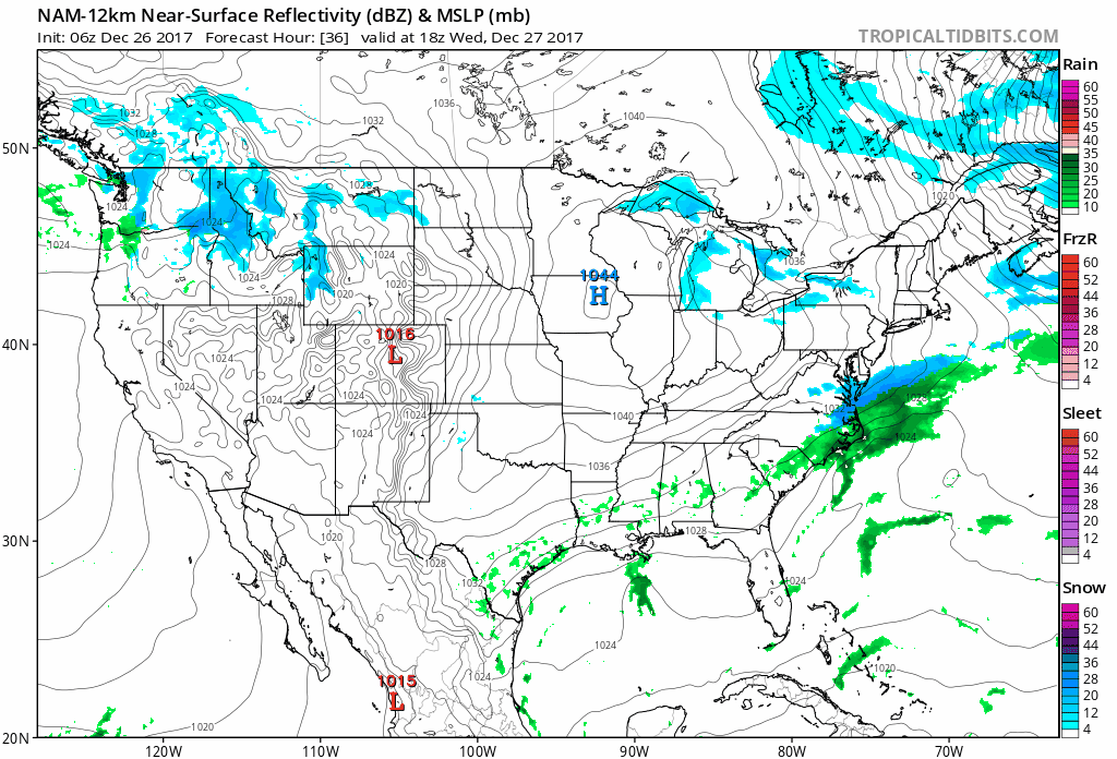
A strong area of high pressure over the Northern Plains today will keep things cold and dry with some sunny skies. However, as the high moves off to the east on Wednesday, several piece of energy will work into the area late this week. The first piece of energy looks to arrive late Wednesday and last into Thursday. This will bring a round of light snow to most of North Dakota and Minnesota.
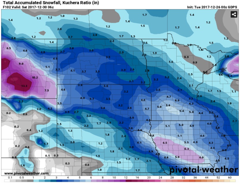
An additional piece of energy will work into the western part of the Northern Plain overnight Thursday and into Friday and bring a better chance at some light snow for South Dakota.

Overall, amounts will be fairly light, with a general 2-4″ over much of the region through this week.
The big story will be the arctic air mass that will drop in behind the final piece of energy overnight on Friday. This will bring dangerous cold and temperatures well below zero for the entire Northern Plains Saturday Morning.
If you have any questions or concerns be sure to contact us at BAMwx.com!