
Good Christmas Eve morning everyone, hope you are all having a Merry Christmas and happy holidays. We have a festive snow on the way for much of the state today!
Right now snow is working into Illinois and extreme Western Indiana. The snow shield will continue to work east throughout the morning hours. Expect snow to enter the western parts of Ohio between 9 and 11AM. As of now it still looks like the heaviest snow will fall in a band in the northwestern corner of the state. We expect a solid band of backside snow to work through the central and southern parts of the state which will impact this evening and into tonight. Overall, the snow should be east of the state early tomorrow morning around 5AM with just a few lingering snow flurries.
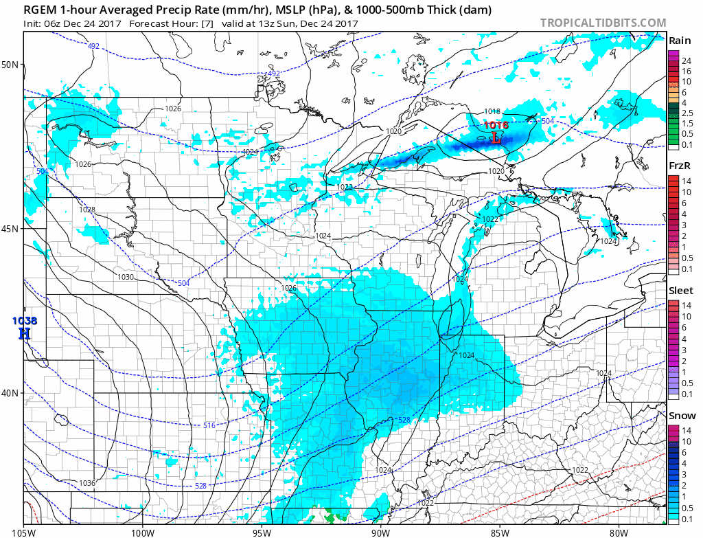
Temperatures could reach above freezing in Southeast Ohio today, but mid to upper 20s will occur where we expect the heaviest snow to fall.

We do expect some clearing for the west and northwest parts of the state Christmas Morning and into the daytime hours. Any sunshine will help road crews with snow removal. The one mitigating factor is that we expect winds to be quite gusty with sustained winds from the west between 10-20 MPH and gusts up to 30MPH. This could create blowing snow at times.

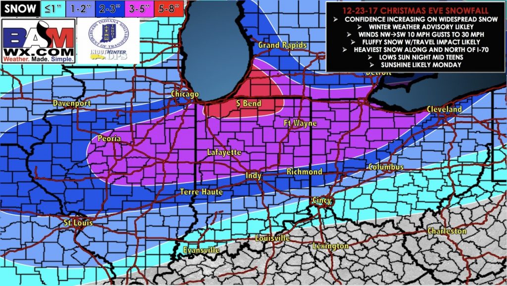
Overall, the heaviest snow of 3-5 inches will fall in Northwest Ohio. Expect about 1-2 inches in Columbus and 2-3″ in Cleveland.
If you have any questions, please contact us and we will be happy to help! Have a very Merry Christmas!