
Good Sunday morning everyone. Hope you are having a great holiday weekend. We wanted to give a quick update on our latest thoughts for today’s accumulating snowfall. Overall, our previous thoughts from yesterday remain, for the most part, unchanged.
We already have snow moving into central and western parts of the state, and it will only continue to build in over the next several hours.

And here’s a look at the current simulated radar forecast today. Snow will work it’s way into the northern third of the state over the next few hours with the southern half of the state filling in this afternoon. The snow shield should be east of the entire state by around 6PM CST tonight.

Temperatures are very cold in the northern half of the state which will lead to high snow to liquid ratios and fluffy snowfall. 
The hi-resolution NAM has a pretty good handle on surface temps. Extreme Southern Illinois could get above freezing later today, but for the most part temperatures will be in the lower to mid-20s for high temperatures. Behind this system with a fresh snowpack and clearing skies, we wouldn’t rule out some temperatures in the low to mid teens in the northern half of the state.

Sunshine is likely on Monday which will help with melting snow off the roads, but winds will be sustained at 10-20MPH with gusts up to 30 from the WNW. This could create some blowing snow overnight and into the morning.
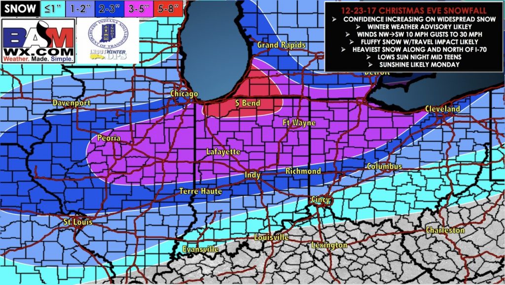
Here is our most updated snowfall map. We expect the heaviest band to be in the central part of the state, with a backside band putting down snow in the southern portion of the state.
Please contact us if you have any questions. Merry Christmas and have a great holiday weekend.