
Video:
Synopsis:
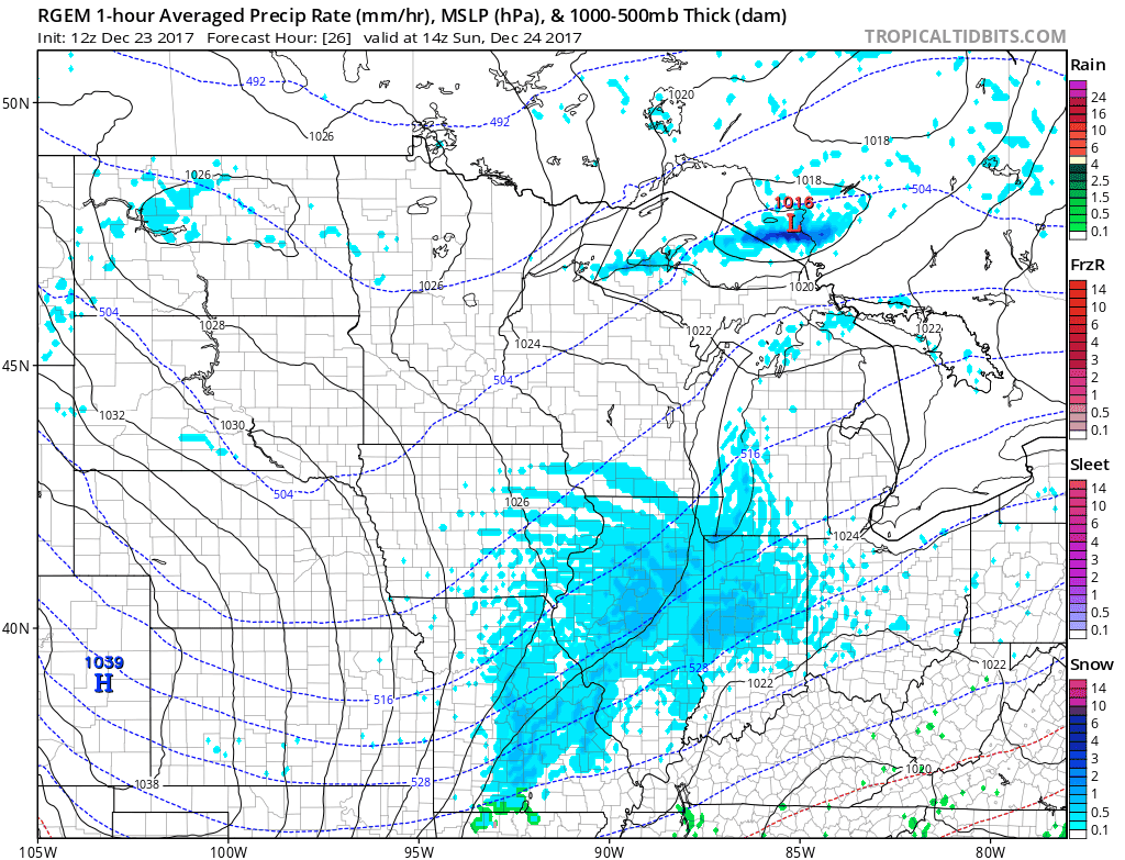
Good Saturday everyone. We increasing confidence of accumulating snowfall for Christmas Eve with high impacts likely. Overall, models have continued to trend further south with the energy associated with this snowfall potential and we have narrowed down the area likely to see the heaviest band of snow. Snow looks to work into the western half of the state Christmas Eve morning and will stick around for most of the day. Far eastern parts of the state will likely see flurries and scattered snow showers overnight Christmas Eve and early Christmas morning. (Timing: 10 AM Tomorrow – 3 AM Monday Morning)
Skies will clear especially in the western half of the state on Monday which will help travel impacts. This will be a fluffy snow given cold temperatures throughout the atmosphere and with sunshine it will help melt snow off the roads quicker.

Some overnight clearing in the western part of the state will also help temperatures plummet, possibly into the single digits in some areas. The RGEM model is showing this possibility nicely.

Winds will also be gusty on Christmas Morning, with winds out of the west and northwest at 10-20MPH with gusts up to 30MPH. Given this, I would not rule out a couple of sub-zero wind chill readings in Northwest Ohio Christmas Morning.
We ended up siding closer with the RPM and RGEM model. We expect a heavy band through Northwest Ohio that will have high travel impacts on Christmas Eve. Winter Weather Advisorys should be coming today for the area. The heaviest snow will still be north of I70, but most of the state will see at least some snow tomorrow into tomorrow night.

If you have any questions be sure to contact us at BAMWX.com.