Synopsis: Good Saturday afternoon! Today’s update is solely focused on the accumulating snowfall as we get into Christmas Eve…it’s important to note we will be targeting 2 waves here…the light and fluffy “clipper-like” system moving east during the morning and early afternoon hours and then a stout lake effect band that will be traversing west to east into tomorrow evening and overnight. Overall timing will be 7amEST-10pmEST…the lake effect band could linger longer across the Ft. Wayne district until ~1amEST before pushing east. We will see a base of 3-5″ with locally higher amounts possible where that localized lake effect band sets up shop (we also expect reduced vis of <0.5 mile and 1-2″/hr snowfall rates from this lake effect band as well). Christmas morning we are waking up to temps in the lower teens and a northwest wind turning eventually southwest with sunshine working in Christmas Day helping pavement temps to warm up and melt some snow. We will have another update ~9pmEST tonight with latest data, let us know if you have any questions…have a blessed day! -Kirk
Today’s video (4 min):
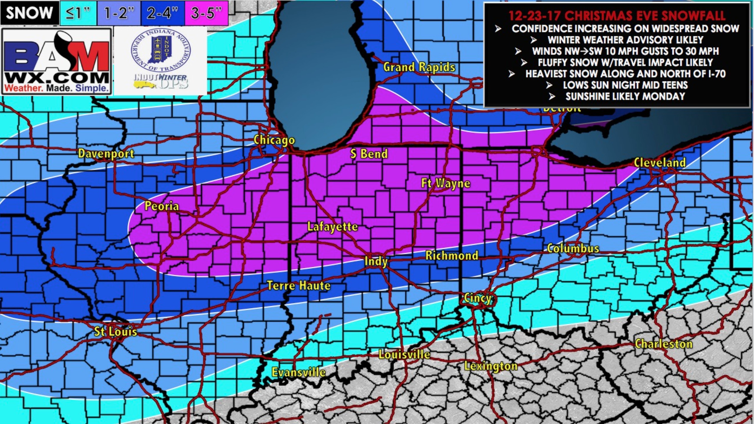
Updated snowfall map…expecting a base of 3-5″ with locally higher amounts of 4-6″ where that lake effect band sets up shop: