Today’s video (7 min):
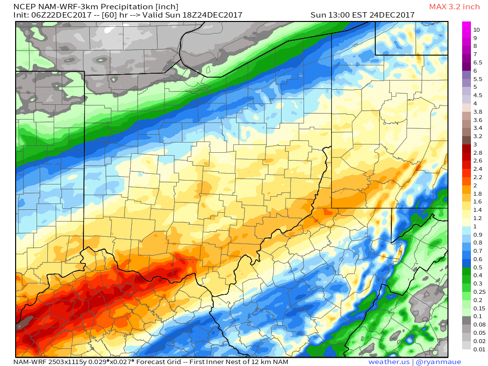
Drizzle and mild conditions persist throughout the day, moderate to heavy rainfall works in later this evening especially south of I-70. Expecting things to transition over to frozen precipitation and likely heavy, wet snow by Saturday morning slowly pushing east throughout the day (again, mainly north of I-70). Things should be all the way out of the state east by 6pm:

Here’s our updated snowfall guidance through Saturday…it’s important to note that a good majority of this will get “eaten” by surface temps being at or slightly above freezing plus the surfaces already being wet. Grassy/elevated surfaces have the best potential for accumulation; areas left untreated will likely be slick as we get into Saturday night which could have some impacts on travel:

Locations south of I-70 likely see heavy rainfall on the order of 1-2″ (localized higher near the River possible) as we go throughout Saturday:
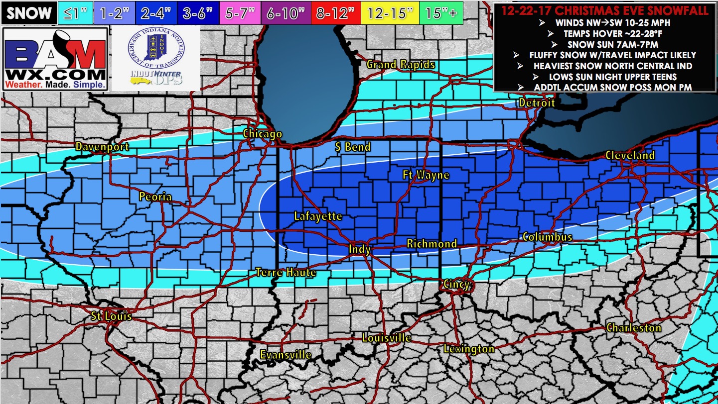
Right on this system’s heels is the Christmas Eve snowfall…temps will be colder here getting into the 20s so expecting this to be a light, fluffy accumulating snow…we time things out in the video (mainly ~10am west to around midnight Christmas morning east):