
Video:
Synopsis:
Good Friday afternoon everyone. We have quite an active holiday weekend ahead with heavy rain impacting much of the state tonight into tomorrow. A brief changeover to snow is possible tomorrow morning into the afternoon. Overall, some slushy accumulation is possible on grassy surfaces, but pavements should remain warm enough to stay wet regardless of any snow that may fall.
This system will bring up to an inch of rain in the extreme southern parts of the state and up to a half inch of rain to much of the state.

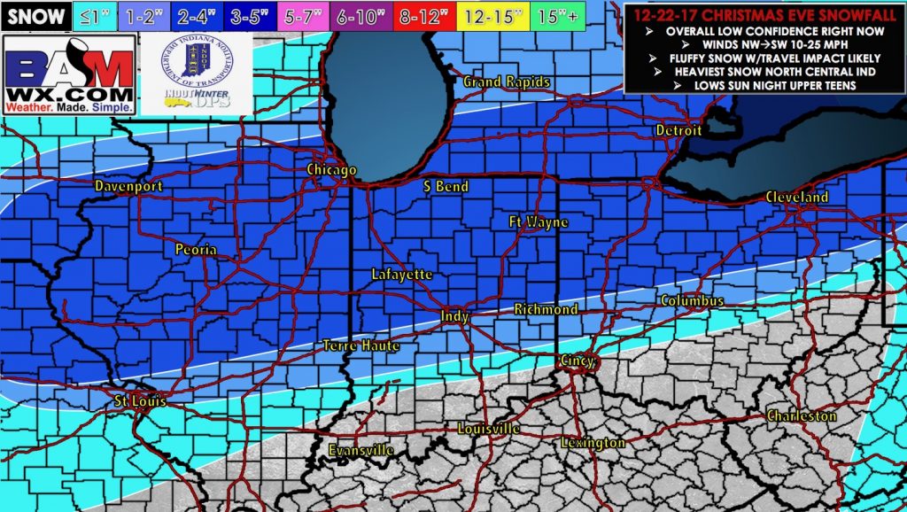
The bigger story for this weekend is the potential for accumulating snow for Christmas Eve. Models still vary a great amount on the timing of this system. High resolution models are currently about 12 hours faster with the potential snow accumulation compared to the global models. Thus, confidence about specific timing details is low at most right now.
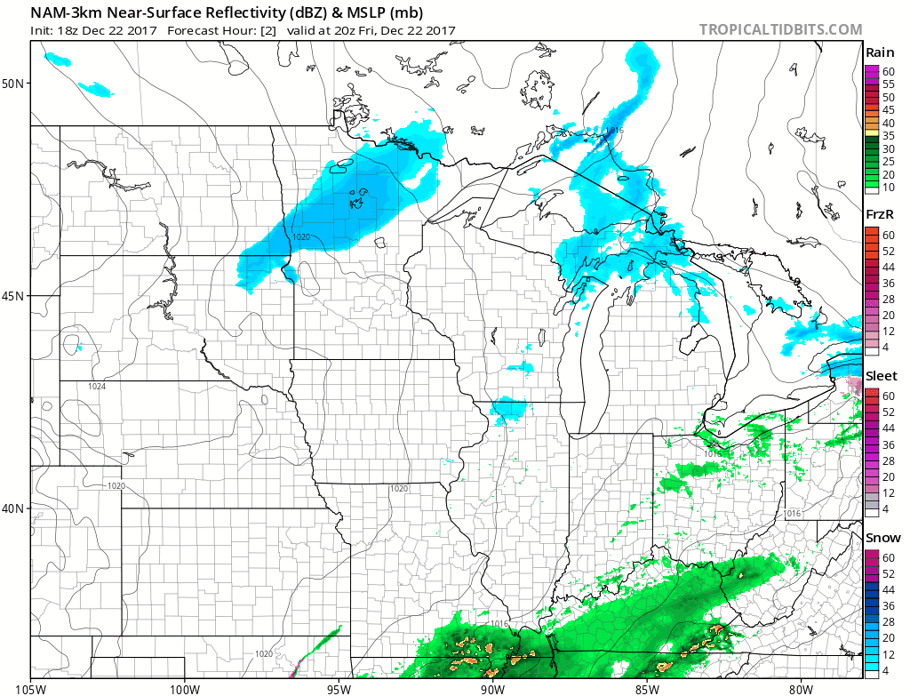
Though models paint a broad area of 1-4 inches of snow in the northern half of Ohio (shown below), the data varies about the location of a narrow, heavier band of snow. Confidence is high, however, that a heavier band of snow will occur given a potent area of upper-level energy diving through the area, a tight thermal gradient and saturation with upper motion in the dendritic growth zone (part of the atmosphere where snow formation occurs). Though, as mentioned above, models vary on the location of this band.

Thus, with these thoughts in mind, here is our updated accumulation map.
*We will continue to monitor the latest data and will have an updated out by 7:30amEST Sat AM…if you have any questions please don’t hesitate to reach out to us at any time*