Video:
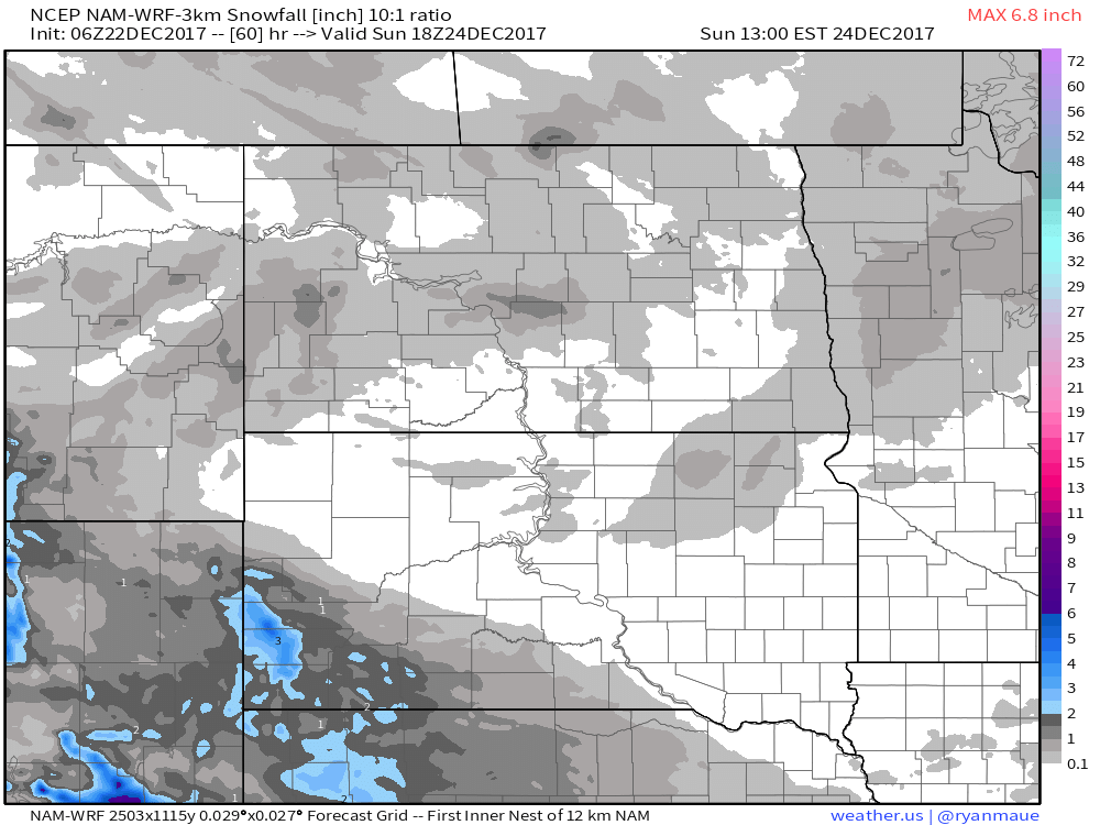
Overall, only very light snow accumulations are on the table into next week, with the exception of Southwest South Dakota. A disturbance late tonight into tomorrow looks to drop a few inches of snow in that area.
Some scattered snow showers are possible Saturday Evening through Christmas Eve night in North Dakota and Minnesota, but accumulations will be light.
The biggest story is the arctic air mass that will bring a series of nights with below zero temperatures in North Dakota/Minnesota and single digits in South Dakota.
Christmas morning will have dangerous wind chills in North Dakota and Minnesota. Unfortunately, wind chill values will stay below zero for all of North Dakota and most of South Dakota into Wednesday.