12-22-17 Northern IN Districts Forecast
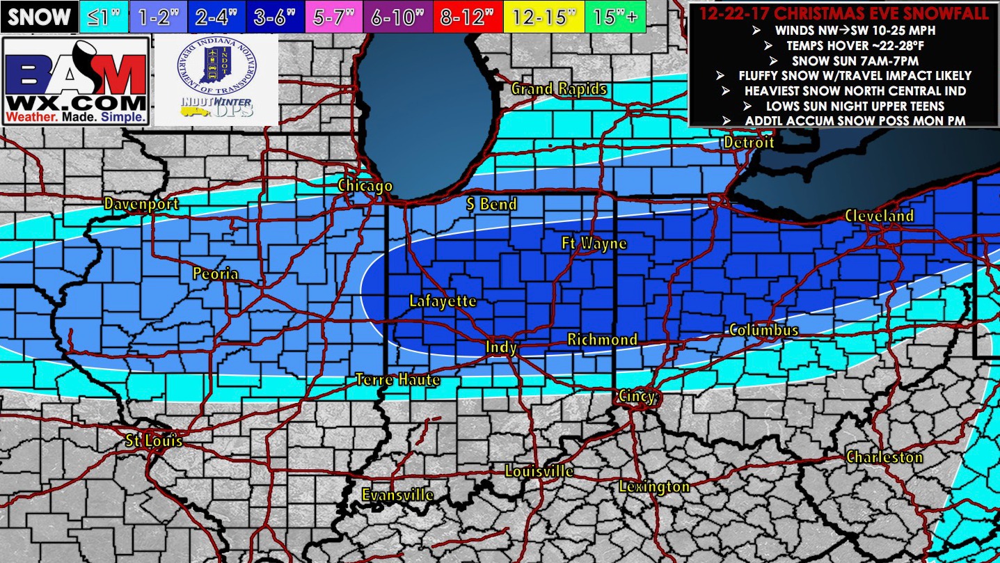
Synopsis: Good Friday morning! Today we discuss multiple waves of wintry precipitation working into the northern Districts as we get into the Christmas timeframe. At times heavy, wet snow will be possible given the temps at or slightly above freezing at the surface across central IN before pushing off to the east between 1-4pm Saturday. It’s important to note that we will be above freezing at the surface so these accumulations will likely melt on contact (grassy/elevated areas it may stick) so not expecting much in the way of travel impacts during the day…at the same time we need to monitor for slick surfaces/refreeze Saturday night where left untreated as we dip into the 20s. Our next more confident snowfall event comes Christmas Eve morning and throughout the day…fortunately we will be dealing with temps all below freezing into the 20s so it’ll be the light and fluffy stuff. Currently we are favoring mainly north of I-70 for the wave to move east. There still is quite a bit of uncertainty as to the orientation and exact track of the heaviest snowfall…we discuss the risks in the video. Let us know if you have any questions, have a blessed day! -Kirk
Today’s video (7 min):
Updated snowfall accumulation map through Saturday evening (slushy, heavy, wet snowfall):

Updated snowfall map for Christmas Eve additional accumulation (light fluffy snowfall…likely will need to adjust the orientation of this accumulation as we get closer):