Today’s video forecast covers the entire region of Indiana, Illinois, and Ohio:
Great weather continues for this first weekend of December!

A storm system will deliver our pattern change early next week. Showers expected to develop on Monday, with widespread rain and gusty storms moving across the state Monday night along a cold front. Very gusty winds will be possible (up to 50 mph) as the front passes. Highs soar to around 60º Monday.
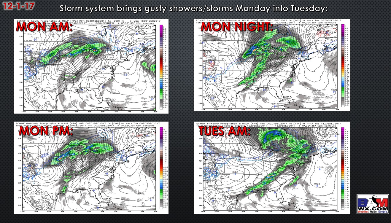
Rainfall with this system looks to be 0.3″-0.75″ in most spots (this model below may be slightly underdone).

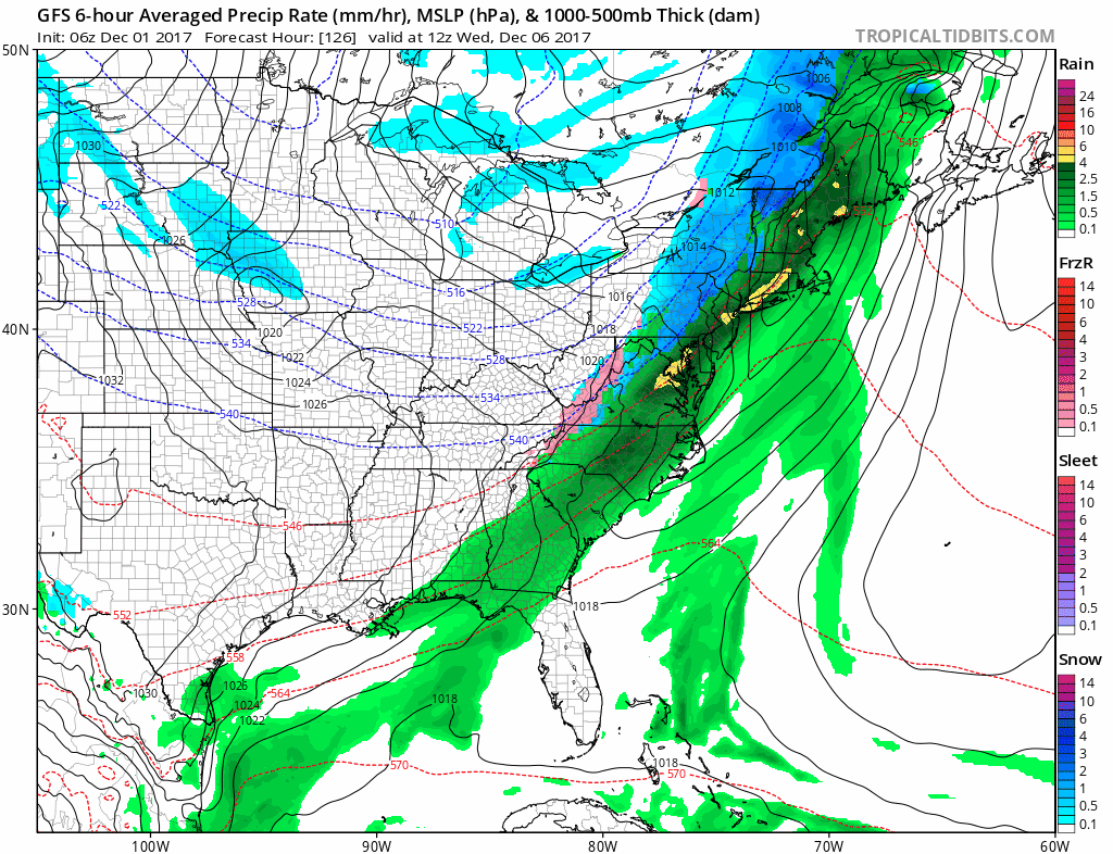
Once the front passes Tuesday, temperatures will continue to drop for the rest of the week, coldest air settles in late Wednesday through Friday. Check out this deep trough settling in!

Specifics on snow chances with this pattern will be difficult to nail down until we get in a closer time-frame, but will have to watch the late part of next week and the weekend for clipper systems to impact the area as the GFS model shows…the pattern favors this set-up. Certainly need to watch lake-effect areas in northern Indiana as well.
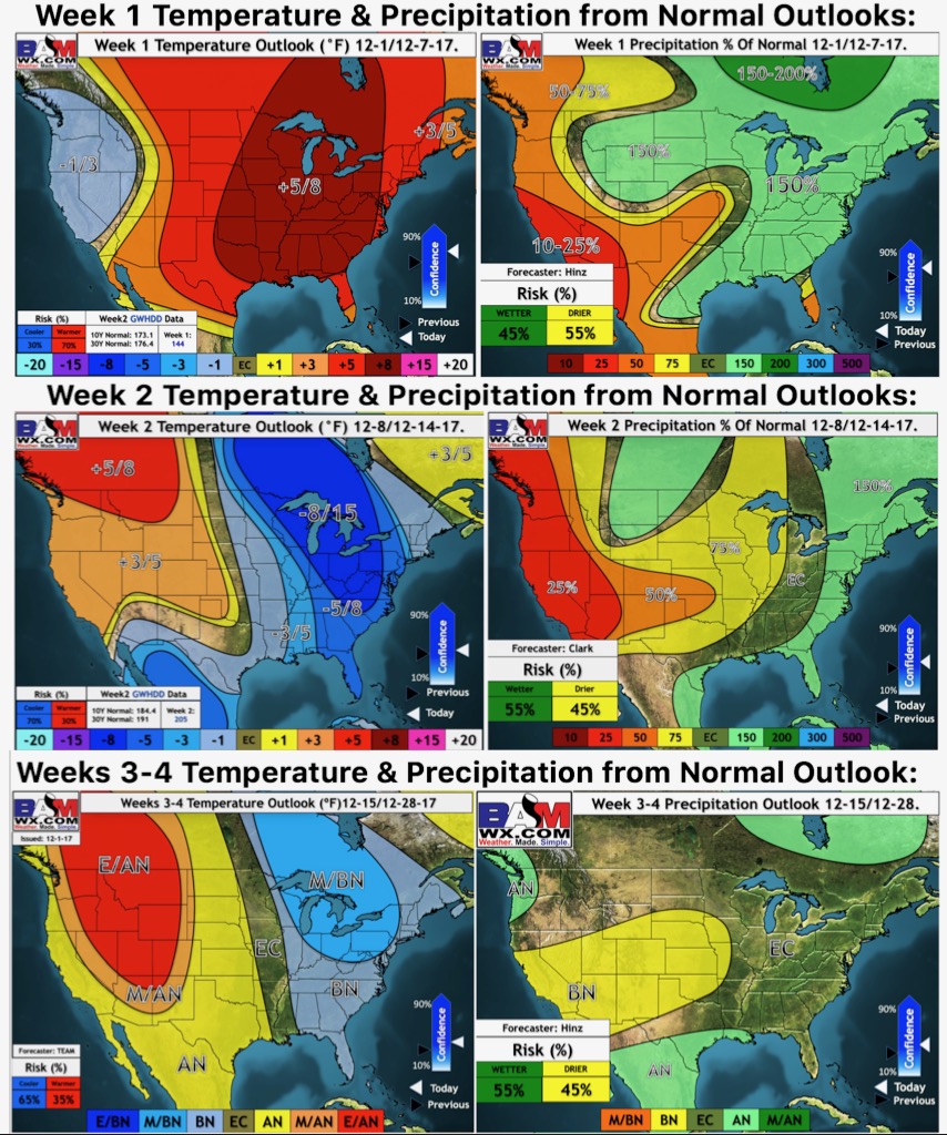
Here are our weeks 1-4 updated temperature and precipitation from normal outlooks: