Key Points - Wednesday, October 25, 2017: Today's video (6 min): http://youtu.be/J9t3iRL3DqM?hd=1 We discuss in today that locations further southeast are susceptible to remaining in the upper 30s Thursday morning; locations further north and west will be much warm influences by the cold front approaching from the west: Next rainfall…
Today's Iowa Forecast: https://www.youtube.com/watch?v=iOUU4SAuLF8&feature=youtu.be&hd=1 Check out the drop in temperatures coming behind our next cold front from Thursday afternoon through Friday morning: Circled area below will have the best chances for snow showers on Friday. The further north you are in this area, the better the risk to see some…
Today's Illinois Video Forecast: https://www.youtube.com/watch?v=o2wWr1wLfZ8&feature=youtu.be&hd=1 Frost advisories for the eastern half of the state tonight: Rain coverage forecast for today and Friday is shown below...no rain expected on Thursday:
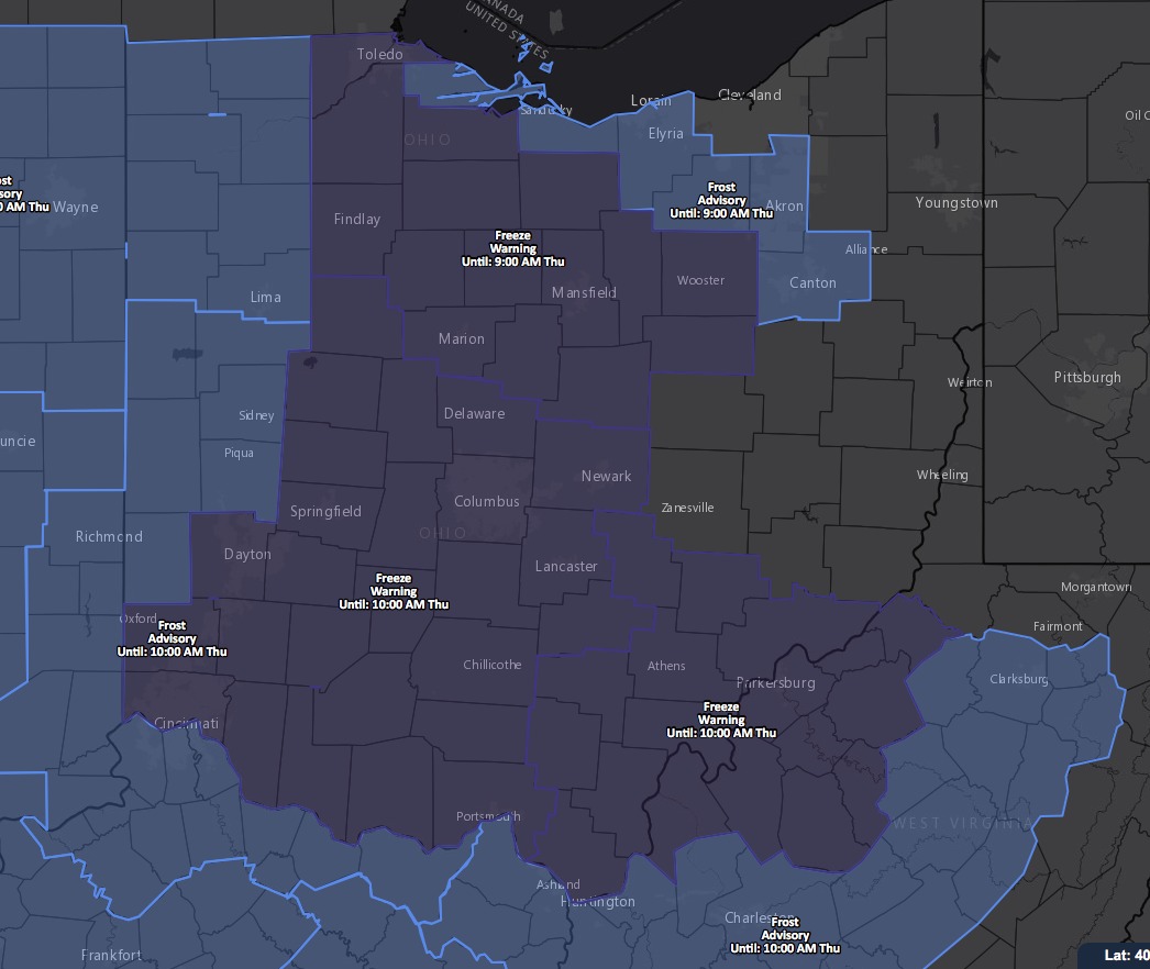
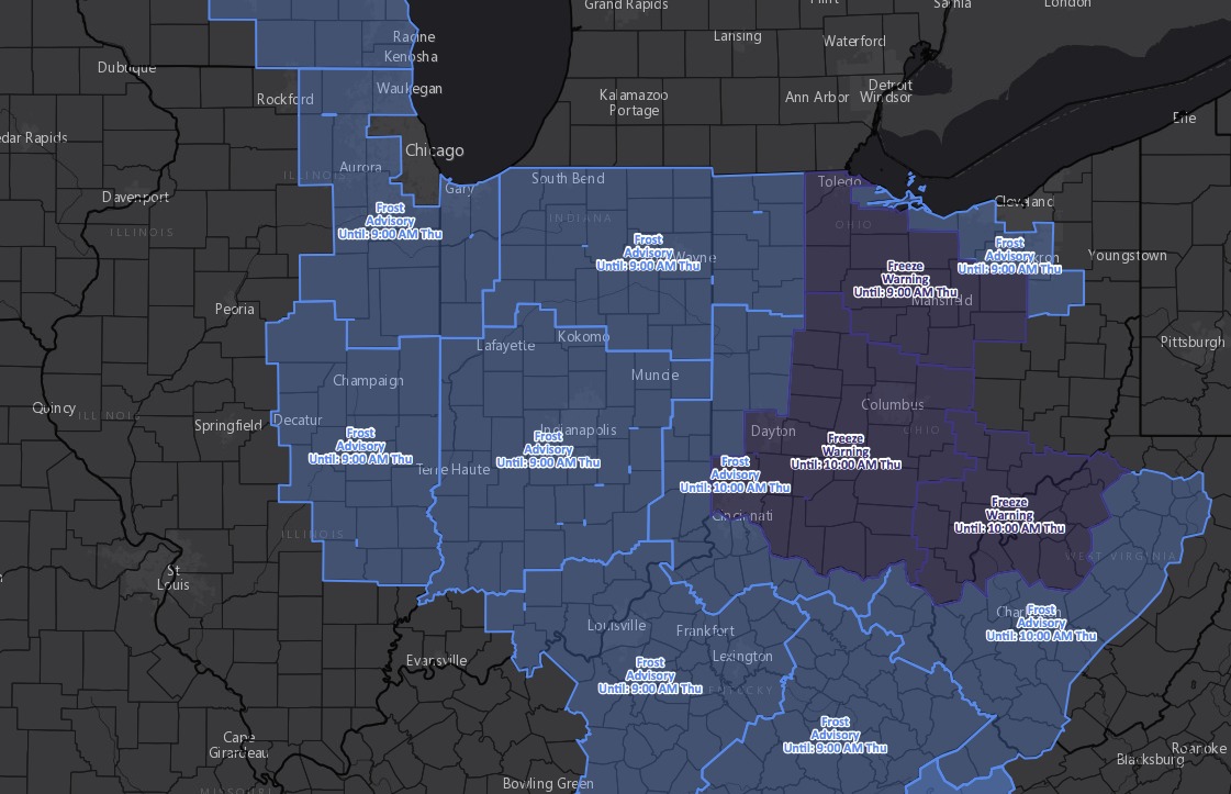
Key Points - Wednesday, October 25, 2017: Today's video (6 min): http://youtu.be/YZpqY-xMd9Q?hd=1 Current frost advisories and freeze warnings for Thursday morning: Here's a snapshot of the temperatures on Thursday morning...with calm winds and clear skies expecting multiple locations to get into the upper 20s and lower 30s: Our next system…
Today's Indiana Video Forecast: https://www.youtube.com/watch?v=A1HBHLSRjrw&feature=youtu.be&hd=1 Here is a look at the rain coverage forecast through late week. A few additional showers today, dry on Thursday. Additional showers build in from southwest to northeast Friday afternoon through Saturday morning along a cold front. As skies clear this evening and overnight along…
Key Points - Wednesday, October, 25, 2017: Synopsis: Good Wednesday morning! Majority of temps in the upper 30s to lower 40s...cloud-cover overnight keeping us a little warmer than guidance yesterday. Widespread frost advisories hoisted for Thursday morning frost potential as we are eyeing for temps to get down into the…
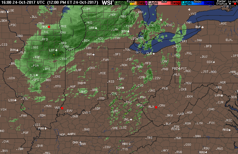
Tues Afternoon Short-Term Update. Hard Frost & More Rainfall. Sharply Colder. Tues PM Short term forecast update. 6 mins. M. https://www.youtube.com/watch?v=4XfR1HGsLvg&feature=youtu.be&hd=1 *PROBABILITY OF FROST FORMATION WED & THUR MORNING. WE DO NOT BELIEVE FROST WILL BE ABLE TO FORM WEDNESDAY MORNING DUE TO BREEZY CONDITIONS AND A DEW POINT TOO…
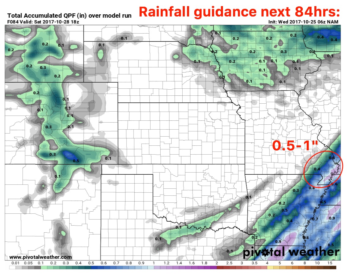
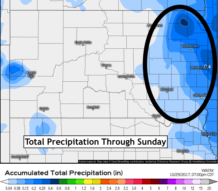
Today's Video (4:34) http://youtu.be/lo-BHYO9qzo?hd=1 Total precipitation through Sunday, most of which will come Thursday into Friday. Updated week 1 and 2 outlooks.