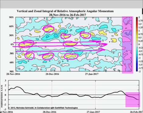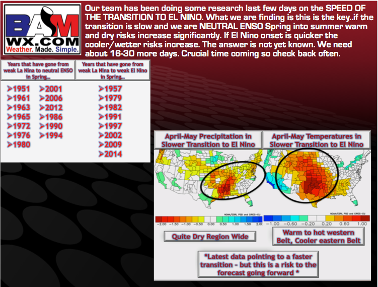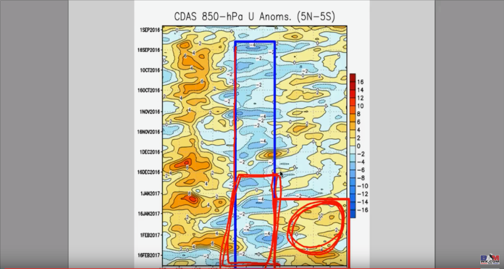
#AGwx #Plant17 #Energy: We explain why SSTs are not the only thing behind “El Nino”. M.
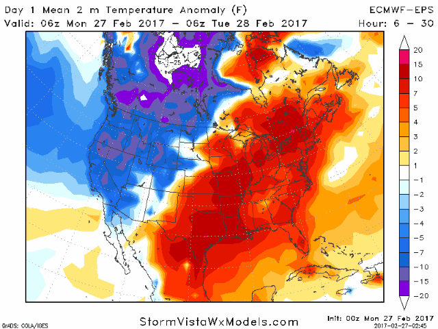
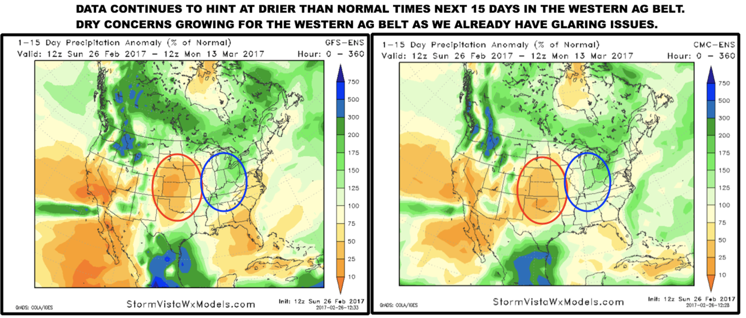
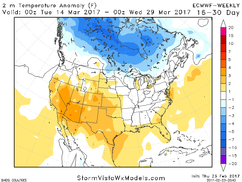
#AGwx #Plant17 #Energy: We explain why SSTs are not the only thing behind "El Nino". M. Synopsis: Weakening pacific jet leading to drier concerns across the western Ag Belt? More record warmth into mid-March as well? We discuss the risks to the forecast going forward, make sure to check out…