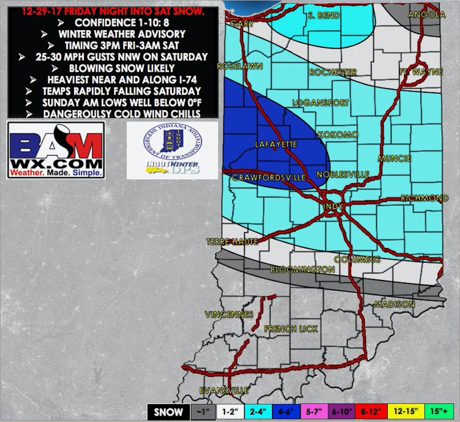
Synopsis: Good Friday morning! Watching a fast-moving clipper system that will push into the Hoosier state this afternoon into tonight. There will be a fine line between snow vs. nothing at all setting up right within our area. Our best idea would be from a Bloomfield to Seymour-Madison line and…
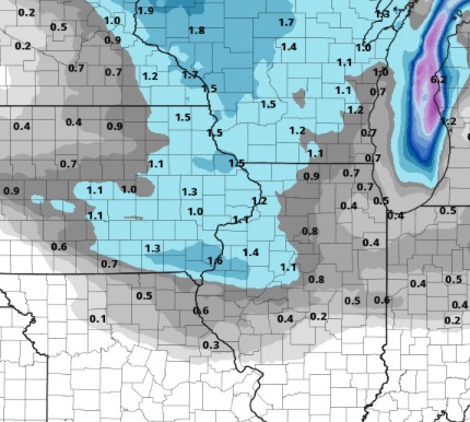
Synopsis: Good Thursday afternoon! We are watching a disturbance that will continue to bring snow showers to the northern half of the state through the late afternoon into early evening. A good coating of snow is possible for the northern half of the state, with some 1-2" amounts in north…
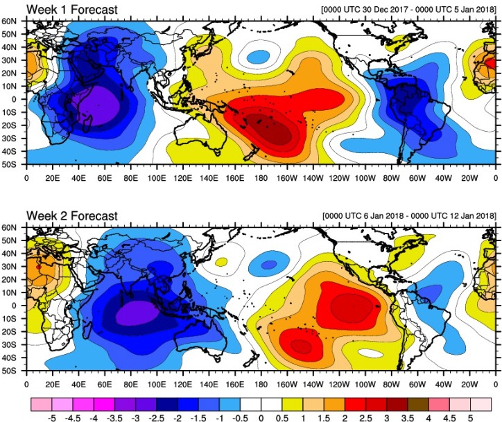
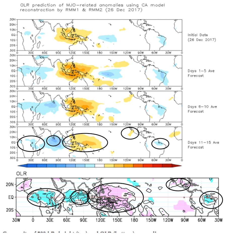
12-28-17 Energy And Natgas Report. Discussing The MJO And Model Performance. Video today is long but loaded with logical analysis on this pattern in the coming 2-3 weeks. I will say if you've seen the new JMA weeklies today to ignore them as they are worthless with respect to how…
Synopsis: Good Thursday morning! Watching an area of light snow showers near Terre Haute as of 5:45 EST. This activity is running into very dry air, so confidence is low whether or not any flurries will impact the area this morning. Areas from near Bloomington to Martinsville would have the…
12-27-16 Energy And Natgas Report. Colder Trends But Most Importantly..WHY. Video today is 7 mins. Starting to get more of a clear picture perhaps..maybe we had the right idea all along? Just watch the video. If you have any questions please let me know. http://youtu.be/Nt6R7bHarB8?hd=1 PDF: energypdf
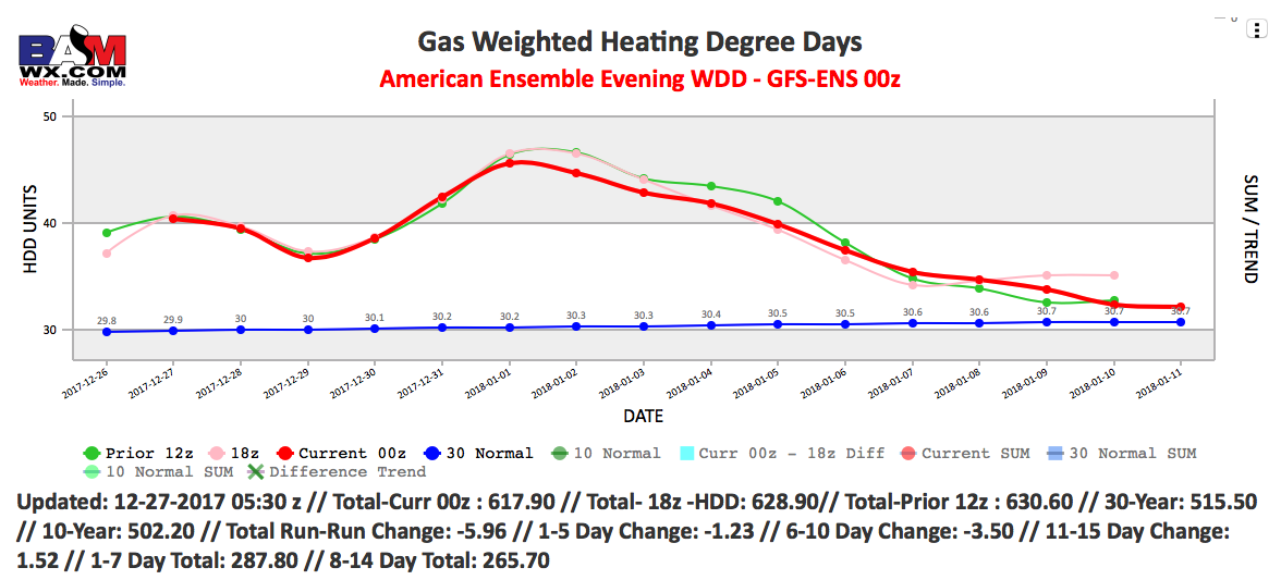
12-27-17 Early AM Energy Check-Up. Colder Trends Overnight In Data. Apologize in the late delivery on the AM sheet today. The Europeans had a supercomputer issue so data was about 3 hours late on our end.
Video: http://youtu.be/D7SWCep71gI?hd=1 Watching for a few impulses of energy to bring additional snow chances to portions of the state over the next 72 hours. Much of today looks just fine with sunshine. Watching a wave of energy late tonight into Thursday morning, then another wave Thursday afternoon/evening: Still watching for…
Synopsis: Good Wednesday morning! Waking up to frigid conditions, with temperatures below zero in northern locations, and single digits south. We target a couple weak impulses of energy over the next couple of days which could generate additional flurries and snow shower chances. The two time-frames I would watch will be…