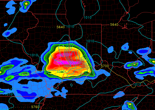
Good Friday Morning. Forecast for the remainder of today is pretty much on track from yesterdays idea. Mostly dry and warm today with temps getting near 80. Tonight a storm cluster fires up and will move through the area between the hours of 8pm-12am. These storms could be strong with damaging winds and vivid lightning, heavy rain too. Here is a look at forecast radar tonight ~9pm:
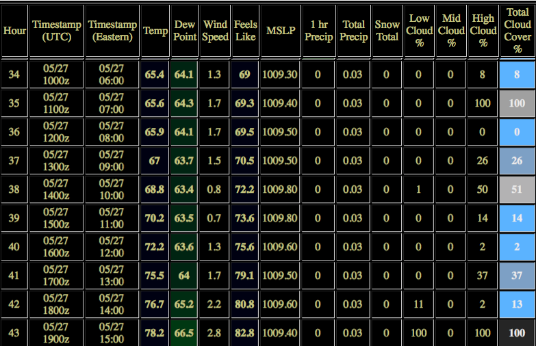
Going forward starting at 6am Saturday out to 3pm here is your hour by hour forecast of weather conditions. We do believe a window of opportunity has developed for the parade to run dry. I will send another hour by hour update here later this evening.
As of right now our team has 2 concerns.
- If its sunny will it allow storms to develop earlier than forecast?
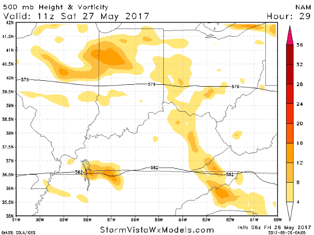
- There is an upper level energy wave in the area and while models are currently dry with this feature concern #1 may aid in storm development earlier than current forecast.
Confidence is a tad lower than normal but the best thing we can do is watch radar and now cast the event with our Meteorologists on site. Like I said a dry window is there. Here is the upper level piece of energy we are watching tomorrow.
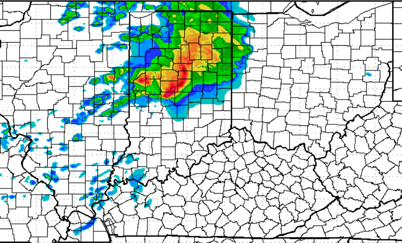
There is for the record a risk of severe storms late Saturday night. Some of these storms could be rather strong once they venture into the area so if anyone is still tearing down I would keep them in the loop for that. Current thinking is 12am-4am Sunday but this is still largely up for grabs. If you have any questions please let me know.