Synopsis: Good Tuesday afternoon! Showers and storms continue to increase across extreme southeast Indiana, Kentucky, and into central/southern Ohio. This area is under a severe thunderstorm watch until 9pm EDT for the potential of a few severe storms, with damaging wind gusts the greatest threat. The rest of the area is starting to dry out, with a cold front working southeastward. Expecting tranquil weather once we get beyond today.
Short-term video (4:42):
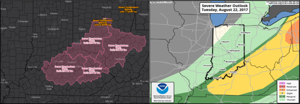
Below is a look at the latest severe thunderstorm watch and severe storm risk going through the rest of the afternoon into tonight. The threat in this area will gradually end from northwest to southeast through the late afternoon and evening.