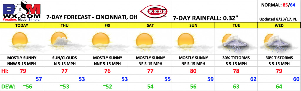
Good Wednesday morning! Great weather is on tap for the rest of the week as high pressure situated across the Great Lakes ushers in a dry air mass and pleasant temperatures. Some changes next week with the return of a few storm chances.
Expect mostly sunny skies today with high temperatures just shy of 80º. Winds will be out of the north-northwest 5-15 mph pumping in a drier air mass. Temperatures will fall rather quickly beyond sunset.
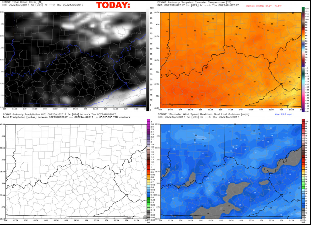
Thursday will feature a mix of sun and clouds with highs in the upper 70s. Winds will be out of the north 5-15 mph.
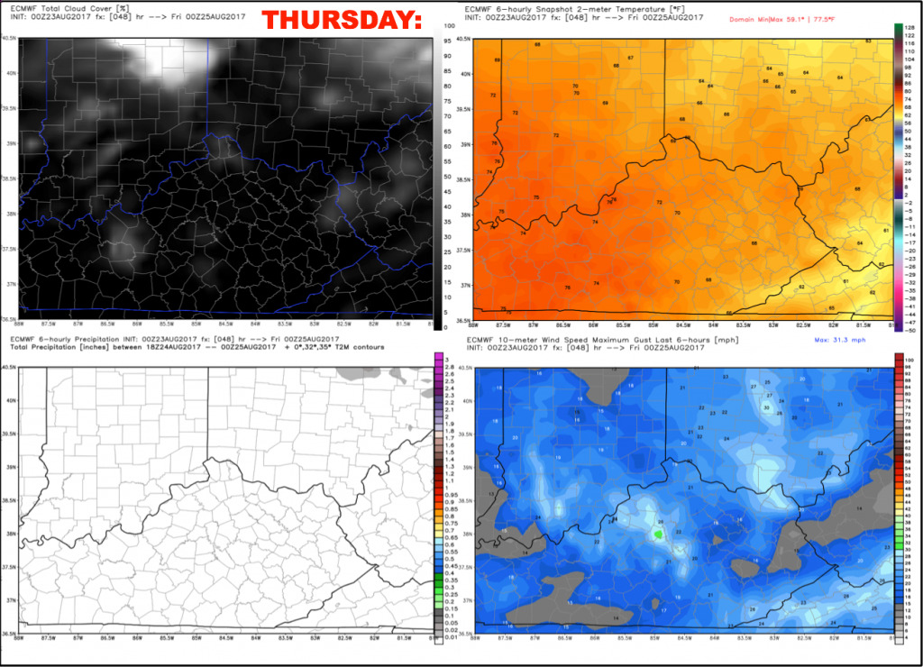
Friday will feature lots of sunshine and continued pleasant temperatures. Highs will top out in the middle to upper 70s. Once again, expect temperatures to fall rather quickly beyond sunset with the dry air mass in place.
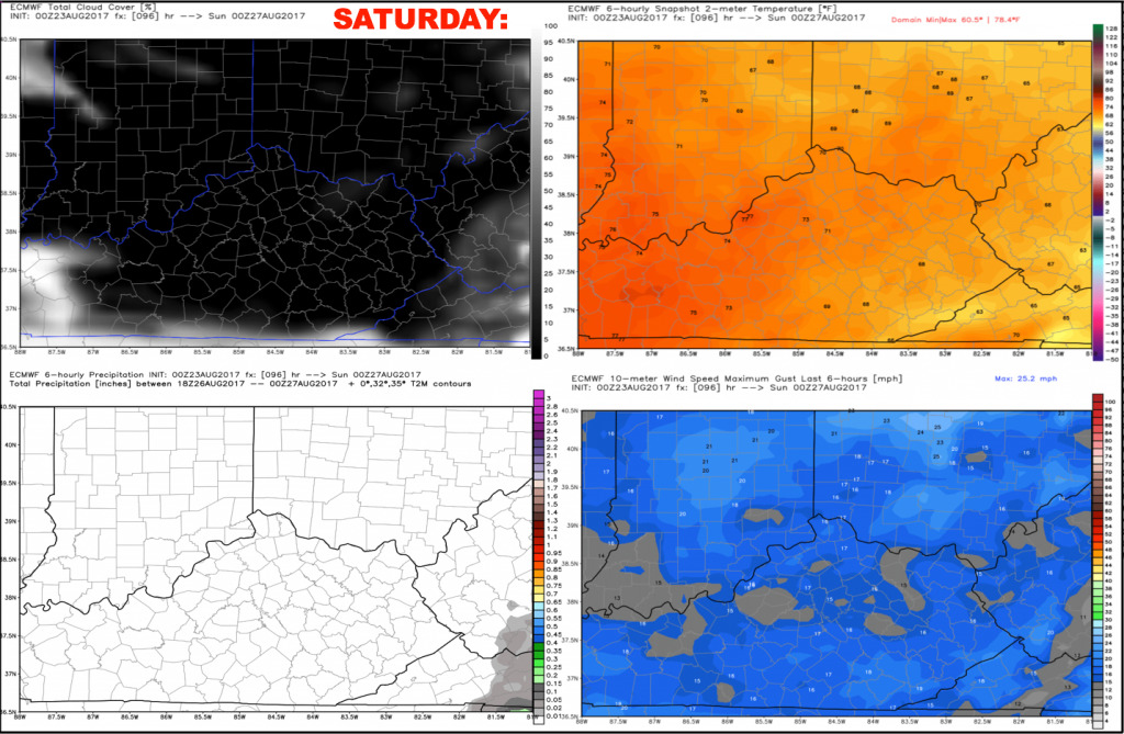
It remains dry throughout the weekend, with very little change in the forecast. Expect mostly sunny skies on Saturday with highs in the upper 70s. Winds will be out of the northeast 5-15 mph.
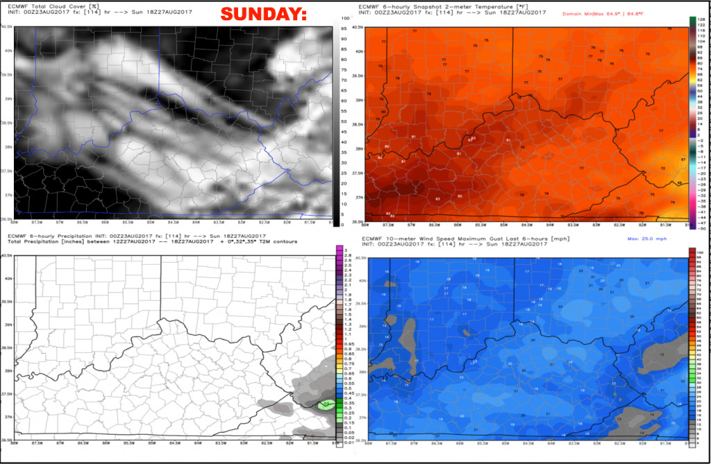
Mostly sunny skies on Sunday with slightly warmer temperatures, topping out around 80 during the afternoon. Northeast winds 5-15 mph.
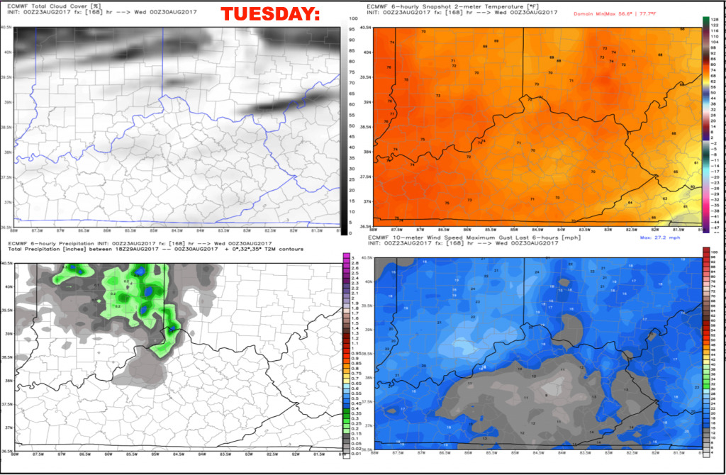
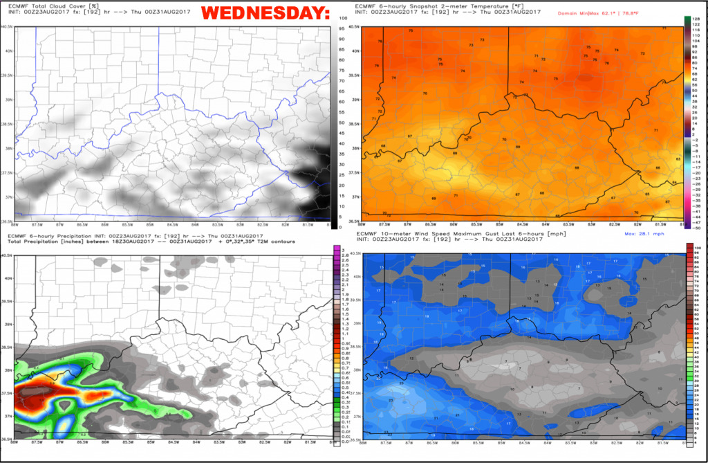
Some changes work in early next week. Uncertainty remains high due to the possibility of tropical system remnants moving northward and affecting the area towards the middle of next week For now, we are looking at a few scattered storms on Tuesday and Wednesday. We will fine-tune this forecast over the coming days.
Have a great day, and let us know if you have any questions!