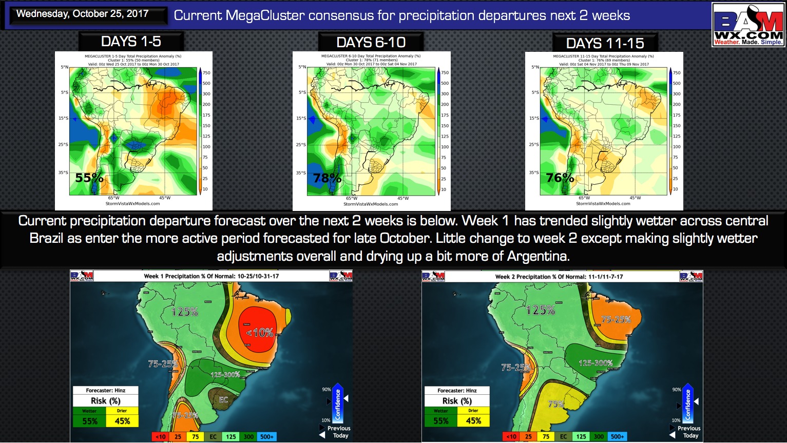
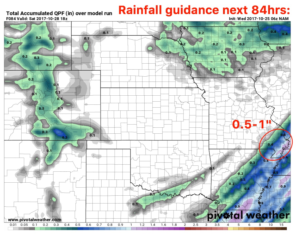
Key Points - Wednesday, October 25, 2017: Today's video (6 min): http://youtu.be/J9t3iRL3DqM?hd=1 We discuss in today that locations further southeast are susceptible to remaining in the upper 30s Thursday morning; locations further north and west will be much warm influences by the cold front approaching from the west: Next rainfall…
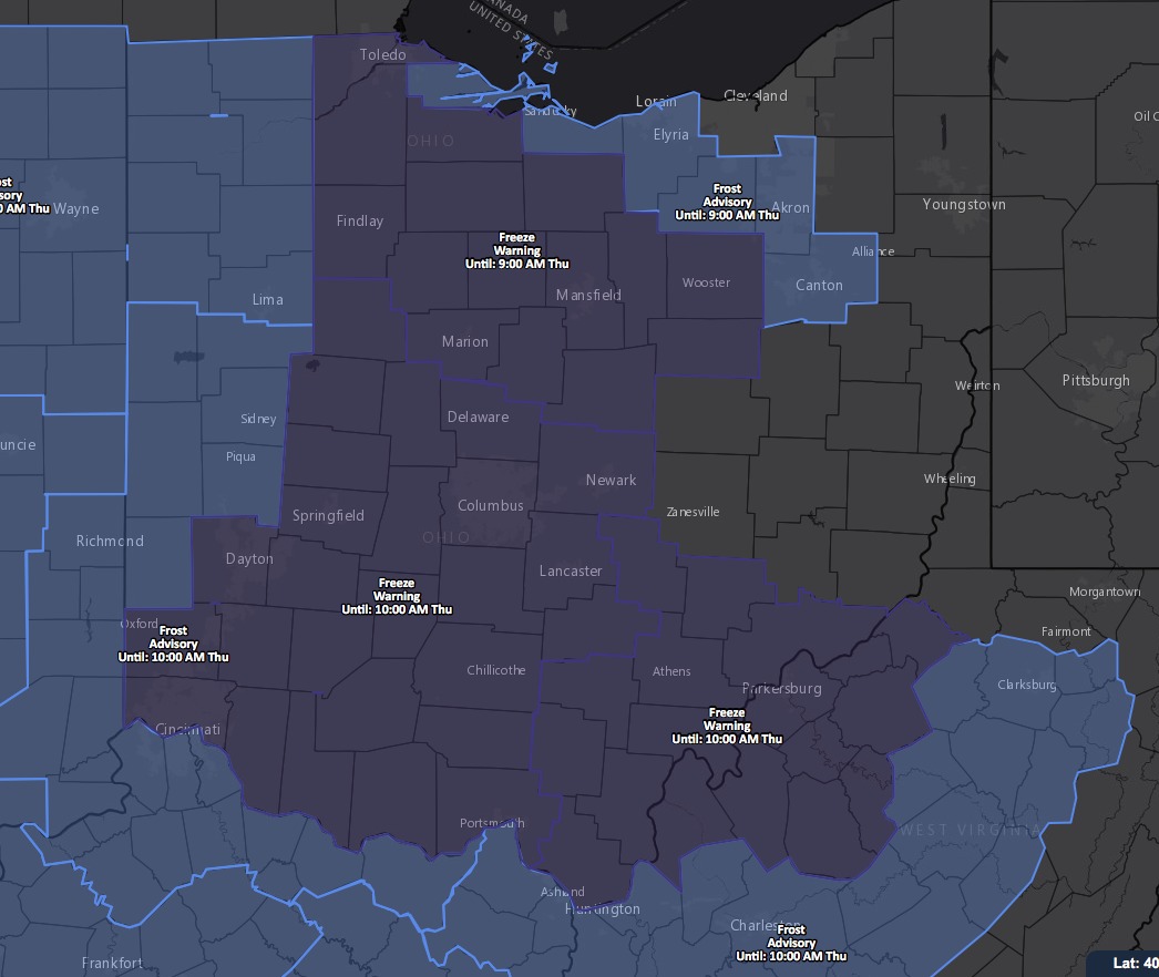
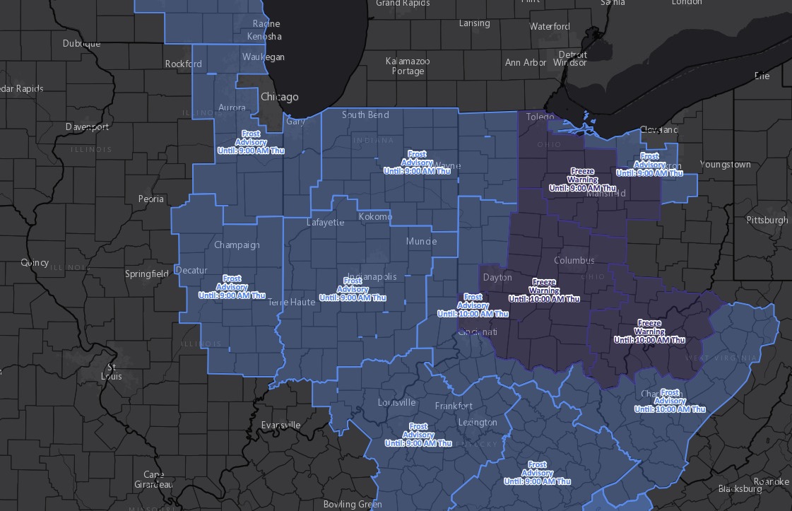
Key Points - Wednesday, October 25, 2017: Today's video (6 min): http://youtu.be/YZpqY-xMd9Q?hd=1 Current frost advisories and freeze warnings for Thursday morning: Here's a snapshot of the temperatures on Thursday morning...with calm winds and clear skies expecting multiple locations to get into the upper 20s and lower 30s: Our next system…
Key Points - Wednesday, October, 25, 2017: Synopsis: Good Wednesday morning! Majority of temps in the upper 30s to lower 40s...cloud-cover overnight keeping us a little warmer than guidance yesterday. Widespread frost advisories hoisted for Thursday morning frost potential as we are eyeing for temps to get down into the…
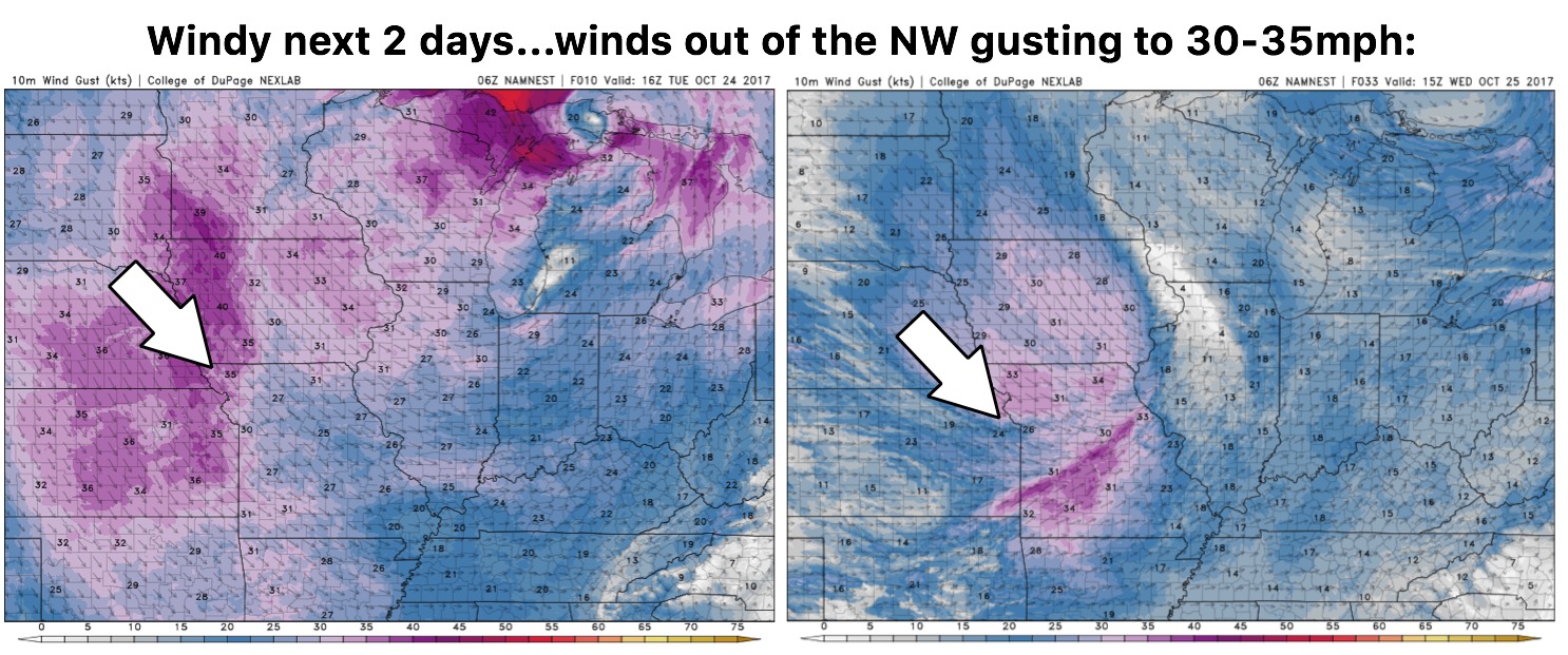
Key Points - Tuesday, October 24, 2017: Today's video (6 min): http://youtu.be/r4kGYVDIVV4?hd=1 Windy next 2 days with winds out of the NW gusting at times to 30mph+: Next best rainfall chance comes along a cold front on Friday...not looking impressive with moisture however, with the exception of locations to the…
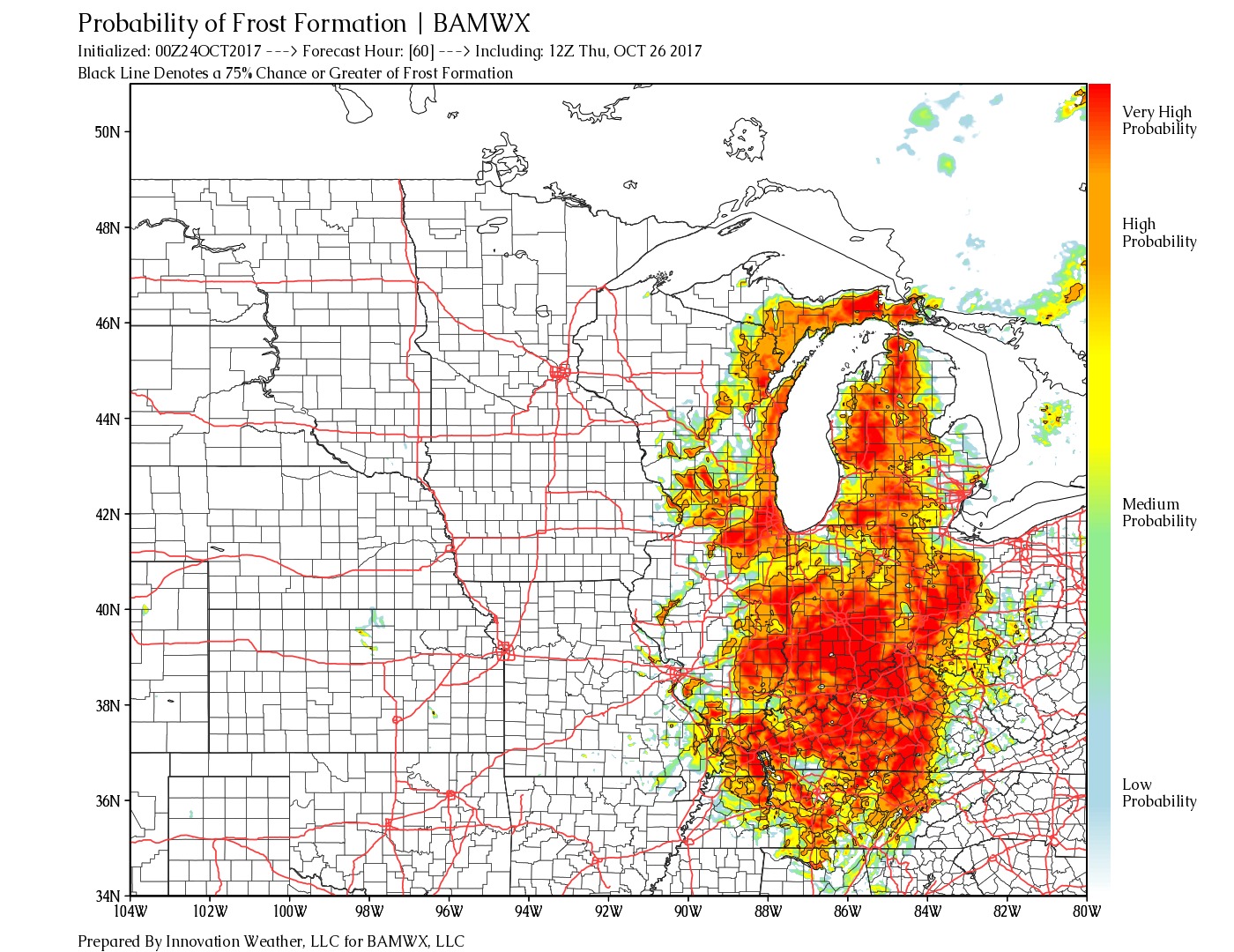
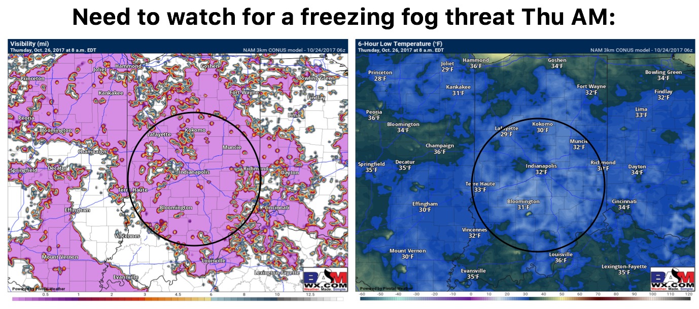
Key Points - Tuesday, October 24, 2017: Today's video (6 min): http://youtu.be/UWtv3t9umtU?hd=1 Rainfall guidance over the next 60 hours...very light, pesky showers, even mist/drizzle conditions lingering over the next 48 hours...the call across the majority of the state is 0.1-0.2". Eyeing more widespread frost risks on Thursday morning as we…
Key Points - Tuesday, October 24, 2017: Synopsis: Good Tuesday morning! Continue to have showers and drizzle moving back in, off-and-on, throughout the day today as a low pressure system lingers throughout the Ohio Valley...much cooler with highs expected to be in the upper 40s and lower 50s at best…