
Video:
Good Thursday Morning!
We are tracking multiple rounds of snow through this weekend and dangerously cold temperatures to follow.
Right now, snow showers and flurries are falling in the northern half of Illinois. Another piece of energy will allow these to continue in a scattered nature throughout the morning and afternoon. Light accumulations of generally less than an inch are possible in the northern third of Illinois.
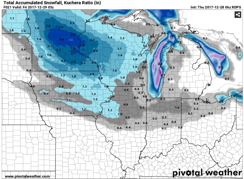
A period of dry weather is likely in the overnight hours before our next wave of energy enters the area tomorrow afternoon and brings a swath of accumulating snowfall through the central portion of the state. Most of the snow should be east of Illinois by Saturday morning.
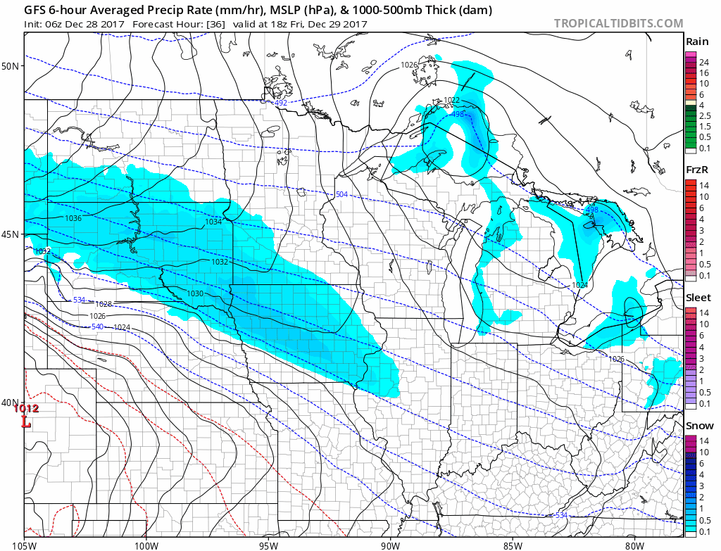
Right now, we’re leaning towards a slightly faster solution than the European and Canadian models given models trends and the climatology of these “clipper” systems.
Overall, right now, our thoughts from yesterday remain unchanged, but we will update with any potential adjustments this afternoon.
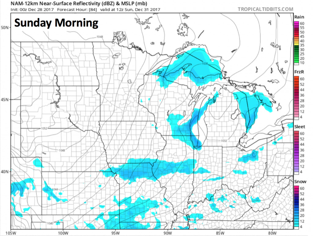
Another weak wave of energy will work through the area on Sunday which could produce some scattered snow showers the first half of your New Year’s Eve.
This arctic high will produce brutally cold temperatures early next week. Low temperatures will likely be below zero for the northern half of Illinois on Sunday, but the real bone-chilling cold begins on Monday. Here’s a look at low temperatures on Monday morning.
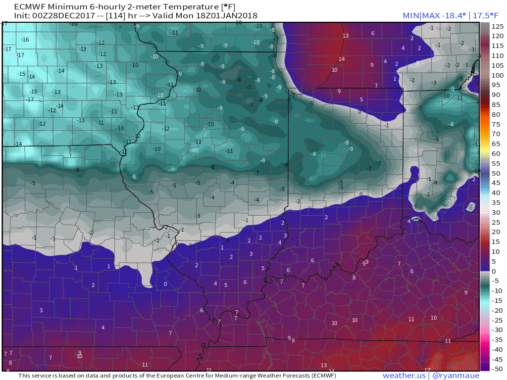
Wind chills could be more than 20 degrees below zero for the northern half of the state on Monday morning. In areas with snow cover, temperatures may not reach above 0 on Monday.
Stay warm, and as always do not hesitate to contact us if you have any questions!